> From the WeatherWatch archives
The Southern Ocean is stormy and is partially to blame for the continued chopping and changing of our weather this January says WeatherWatch.co.nz.
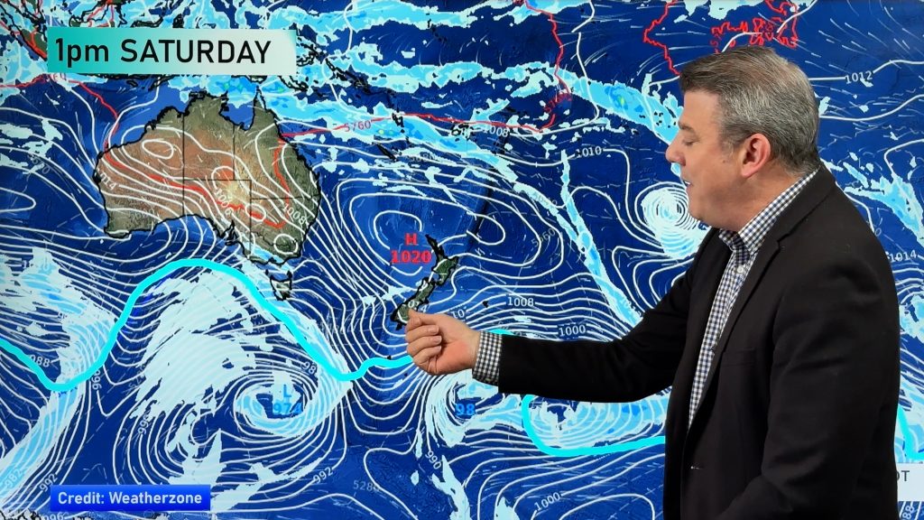
Head weather analyst Philip Duncan says the Southern Ocean is still packing a punch despite New Zealand heading towards the middle of summer. “We often see a late spring pattern dying out in early January but this year the Southern Ocean is packed with storms – add on top of that no really big highs over top of New Zealand and that’s why we’re seeing a combination of all types of weather, especially in the South island”.
So far this month there has been snow, gales, extreme heat, cloud, flooding and sun. However most extreme weather events have been fairly isolated. “The Southern Ocean is as stormy as spring at the moment however unlike spring most of the stormiest weather remains south of the country”.
“We are seeing some very deep lows in the Southern Ocean and while they aren’t directly hitting us a lot of them are swiping the South Island”.
The highs remain in the Tasman Sea, sometimes helping bring hot Australian air over the country, but at other times directing a cooler south west flow, again this is more like spring.
“We also have tropical cyclone Narelle which on Monday was still a category 2 cyclone off western Australia. Sounds like something we wouldn’t have to worry about here in New Zealand however the remnants of Narelle will pass Perth over the next day or two then it will drop into the Southern Ocean and help deepen a storm down there”
Mr Duncan says the storm will remain well south of New Zealand but is likely to clip southern New Zealand this Friday or Saturday with perhaps another surge in wind and rain – a long trip for Narelle’s remnants.
As for the areas that most need rain, unfortunately the set up isn’t looking too great. “When the rain is coming from the Tasman or Southern Ocean it rarely has much impact across eastern New Zealand in summer” says Mr Duncan. “We need to watch the tropics or hope that a low forms east of New Zealand to drive in rain to places likes Hawkes Bay and Canterbury”. At this stage, no models are predicting that over the next week.

The nasty low south of NZ will be partly fueled by ex-cyclone Narelle – predictive rain and wind map for this Friday courtesy of weathermap.co.nz – click on Maps above for more.
– WeatherWatch.co.nz
Comments
Before you add a new comment, take note this story was published on 14 Jan 2013.


Add new comment