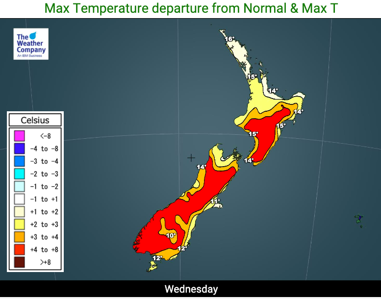
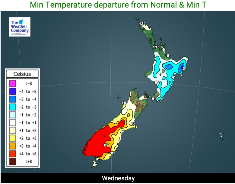
So much for the depths of winter! Sub-tropical winds push temperatures above normal (+6 Maps)
28/07/2020 10:53pm

> From the WeatherWatch archives
This is supposed to be the coldest time of the year but it doesn’t feel it thanks to northerly and sub-tropical winds, which are developing.
The northerly quarter flow will be with New Zealand until the start of next week.
A large high pressure system east of NZ is encouraging the sub-tropical flow down across the country. It’s one of a number of anticyclones this winter which have behaved this way.
Traditionally this is the coldest part of the year (late July and early August).
The North Island has one last night being below average tonight, thanks to the calming nature of the centre of the high which is just holding on to parts of the North Island. The nights ahead will start to warm up in the north too and across Thursday PM the North Island will start to notice this milder northern airflow.


www.WeatherWatch.co.nz
Comments
Before you add a new comment, take note this story was published on 28 Jul 2020.


Add new comment