Severe weather possible this weekend as wind & rain set in (+6 Maps)
2/07/2018 11:30pm

> From the WeatherWatch archives
High pressure in the Tasman Sea is encouraging a fairly gentle southerly airflow across New Zealand bringing sunny weather to many regions, although some cloud remains in the south and east.
By Thursday this high will be drifting more so over the North Island and this will allow a mild nor’west flow to develop in the lower half of the South Island.
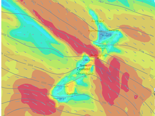
Once we get to Friday those strong winds move up to Cook Strait and then on Saturday cover the entire country, continuing on Sunday too. NW winds will be strongest in Central New Zealand / Cook Strait area with gales possible at times. There is a chance of land wind warnings. Generally speaking most winds are below warning criteria and below damaging threshold – but there is the chance of it getting over that more severe threshold.
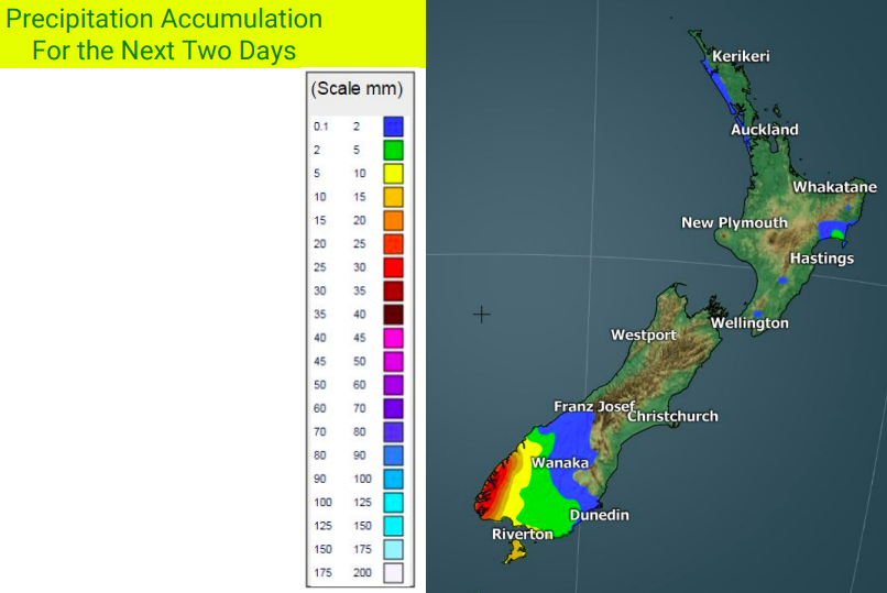
Rain will also become a main feature on the West Coast and by the end of the weekend will be pushing more into the North Island. Some rain warnings are also a possibility due to two or three days of similar weather. Eastern areas, while blustery at times, may be mainly dry and even sunny at times under this set up.
In the meantime, enjoy the calm weather thanks to the high which will be lingering for another 48 hours across the country bringing some frosts overnight tonight but in the coming days warmer than average afternoons and nights for many areas.


WIND MAP FOR NOON SUNDAY:
WIND MAP FOR NOON SUNDAY:
– WeatherWatch.co.nz
Comments
Before you add a new comment, take note this story was published on 2 Jul 2018.


Add new comment