> From the WeatherWatch archives
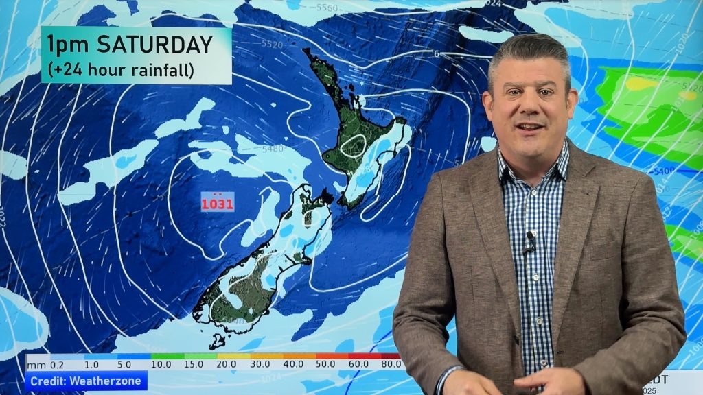
A cold southwesterly airflow lies over New Zealand today, a front hits the lower South Island later this afternoon / evening reaching the upper South Island overnight.
Northland, Auckland, Waikato & Bay Of Plenty
Cloudy areas and occasional showers. The Bay Of Plenty may stay fairly dry all day but there is the risk of a shower spreading from the west at times, especially for western Bay Of Plenty. Brisk southwesterly winds.
Highs: 13-15
Western North Island (including Central North Island)
Morning showers may be heavy with small hail then easing, some sun breaks through at times by midday. Snow flurries to 600m in the morning lifting to 800m around midday. Fresh west to southwesterly winds, strong about coastal areas especially morning.
Highs: 10-14
Eastern North Island
Morning showers possibly heavy with small hail then sunny areas increase in the afternoon, fresh southwest winds ease in the evening. Gisborne may stay fairly dry.
Highs: 12-14
Wellington
Morning showers clear then sunny areas increase, southerlies tend northwest in the afternoon.
High: 12
Marlborough & Nelson
Early rain / showers clear Marlborough then becoming sunny in the morning, light winds tend northwest in the afternoon. Nelson has a mostly sunny day with southwesterlies easing in the evening. High cloud develops from afternoon for both regions.
Highs: 12-14
Canterbury
Early showers clear then becoming mostly sunny, a late evening or overnight southwest change brings rain.
Highs: 10-12
West Coast
A dry morning for most, showers about Fiordland however then turning to rain in the afternoon with heavy falls. Showers move into North Westland during the afternoon turning to heavy rain in the evening. West to northwesterly winds change southwest later in the day.
Highs: 10-11
Southland & Otago
Thickening high cloud, late afternoon rain moves in with a chance of heavy falls / hail as northwesterlies change breezy west to southwest. Rain moves into Otago in the evening. Rain eases back to showers in the evening / overnight with snow flurries lowering to 300m.
Highs: 9-12
By Weather Analyst Aaron Wilkinson – WeatherWatch.co.nz
Comments
Before you add a new comment, take note this story was published on 2 Aug 2019.


Add new comment