> From the WeatherWatch archives
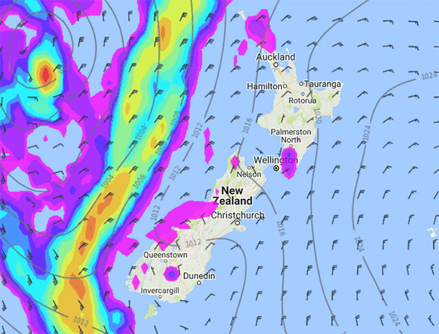
A large high is centred out to the east of New Zealand today, meanwhile a low is brewing in the Tasman Sea. These two systems combine to bring a muggy northeasterly airflow over both the North and South Islands.
For the upper North Island there may be a light shower or drizzle patch at times anywhere from Northland down through to East Cape. The Waikato across to East Cape may see more frequent areas of dry from afternoon. There is the low risk of an isolated shower this afternoon about inland hills / ranges of Wellington and the Wairarapa, any of these showers will clear this evening.
For the South Island we see a few morning drizzle patches about Nelson and the Marlborough Sounds then drying out this afternoon. The West Coast sees a drizzle patch or two at times throughout today, expect periods of dry at times though.
Late afternoon / evening isolated showers develop about Southland and inland parts of Otago, these showers may become heavy with the risk of a thunderstorm then clearing later on today.

Image – Tuesday 16th January 2018 4pm MSLP / Rain map – weathermap.co.nz
WeatherWatch.co.nz
Comments
Before you add a new comment, take note this story was published on 15 Jan 2018.


Add new comment