> From the WeatherWatch archives
It looks like a wild ride for many areas tomorrow as the new year gets underway.
Wind and rain warnings have been issued by MetService as very heavy rain, thunderstorms and high winds are set to cover much of the Mainland.
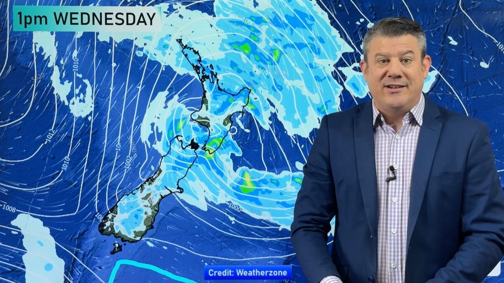
There’s also a chance blustery winds and heavy rain could impact on the lower North island however it hasn’t reached the warning criteria as yet. Wednesday appears more likely for many areas across the north.
Below is the information released earlier today…
SEVERE GALE WARNING
Inland parts of Central and North Otago, also inland Canterbury
Northwesterlies are expected to become blustery this afternoon, reaching gale in exposed inland places this evening and lasting throughout Tuesday. From tonight and during Tuesday, severe gale gusts of 120km/h are possible but gusts could reach 140km/h about the Canterbury High Country on Tuesday.
HEAVY RAIN WARNINGS
Fiordland
Rain is expected to become heavy during this afternoon and remain heavy at times until Wednesday morning. In the 36 hours from 3pm Monday until 3am Wednesday, expect 250 to 350mm of rain, but possibly 400mm in a few places. Intensities may reach 20 to 25mm per hour.
Westland from the Glaciers southwards
Rain is expected to become heavy this evening and remain heavy at times into Wednesday. In the 42 hours from 6pm Monday to midday Wednesday, expect around 300 to 400mm of rain, but possibly 500mm in some places in the ranges. More than 100mm is likely near the coast. The heaviest falls are likely later Tuesday and early Wednesday when intensities could reach 30 to 40mm per hour in thunderstorms.
Westland between Otira and the Glaciers
Rain is expected to become heavy this evening and remain heavy at times for almost two days. In the 45 hours from 9pm Monday to 6pm Wednesday, expect around 350 to 450mm of rain, but possibly 500 to 600mm in some places in the ranges. More than 100mm is likely near the coast. The heaviest falls are likely later Tuesday and during Wednesday when intensities could reach 30 to 40mm per hour in thunderstorms.
Headwaters of the Otago Lakes and Rivers
Rain near the Divide should become heavy this evening. In the 36 hours from 6pm Monday until 6am Wednesday, expect 250 to 300mm of rain on the Divide, with 100 to 150mm (or possibly more) falling within 20km east of the Divide. The heaviest falls are likely overnight tonight and during Tuesday morning.
Headwaters of the Canterbury Lakes and Rivers
Heavy rain is expected to develop near the Divide this evening and may remain heavy at times into Wednesday. In the 39 hours from 9pm Monday until midday Wednesday, expect 250 to 350mm of rain on the Divide, with 150 to 200mm (or possibly more) falling within 25km east of the Divide. Note, rain could continue into Wednesday afternoon and evening. The heaviest falls are likely later Tuesday and Wednesday morning with thunderstorms on the Divide.
Comments
Before you add a new comment, take note this story was published on 31 Dec 2012.


Add new comment