> From the WeatherWatch archives
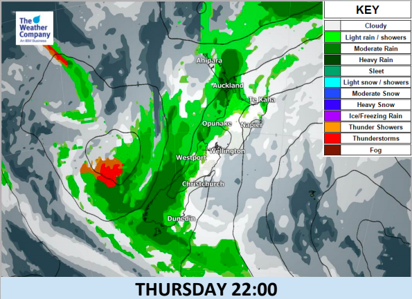
A low pressure system is still located to the west of the South Island, bringing persistent rain to West Coast
and some rain spilling over into Southland. Another small low has formed off Cape Reinga and sparks showers over Northland and Auckland today – along with long dry spells and plenty of cloud.
On Friday rainfall will be enhanced on the West Coast. Hours of showers will be also likely in Otago and Canterbury mainly in the afternoon.
The quasi-stationary front between the low in the west and a high in the east persists off the western
coastline of the country until Sunday. This means New Zealand is stuck in a rut weatherwise until the start of next week with little change.
After a break on Saturday, a period of heavy rain along the front will occur on Sunday across Northland,
Auckland, Taranaki, and the western side of the South Island – but it’s quite hit and miss and patchy as you can see in the maps below.


– WeatherWatch.co.nz
Comments
Before you add a new comment, take note this story was published on 28 Feb 2018.


Add new comment