NZ & Australia weather highlights next few days as lows move in (+14 maps, +2 animations)
27/08/2021 9:24pm

> From the WeatherWatch archives
Here are maps and highly detailed bullet points covering the main weather highlights this weekend and for the final days of August across NZ and Australia.
NEW ZEALAND:
- A frontal boundary associated with a large low pressure system over the Tasman Sea produces moderate to locally heavy rain across portions of the North Island and the upper South Island Saturday.
- While rain will taper off Sunday onwards, light to moderate showers (locally heavy) will linger across the North Island through to the middle of next week as the low stalls near the North Island and falls apart.
- Most impacted by the heavy rain will be Bay of Plenty with 80-100 mm of total rainfall during this weekend. Portions of Northland, Auckland, Wellington and upper West Coast also receive 50 mm or more rainfall, while downpours should ease in the upper South Island.
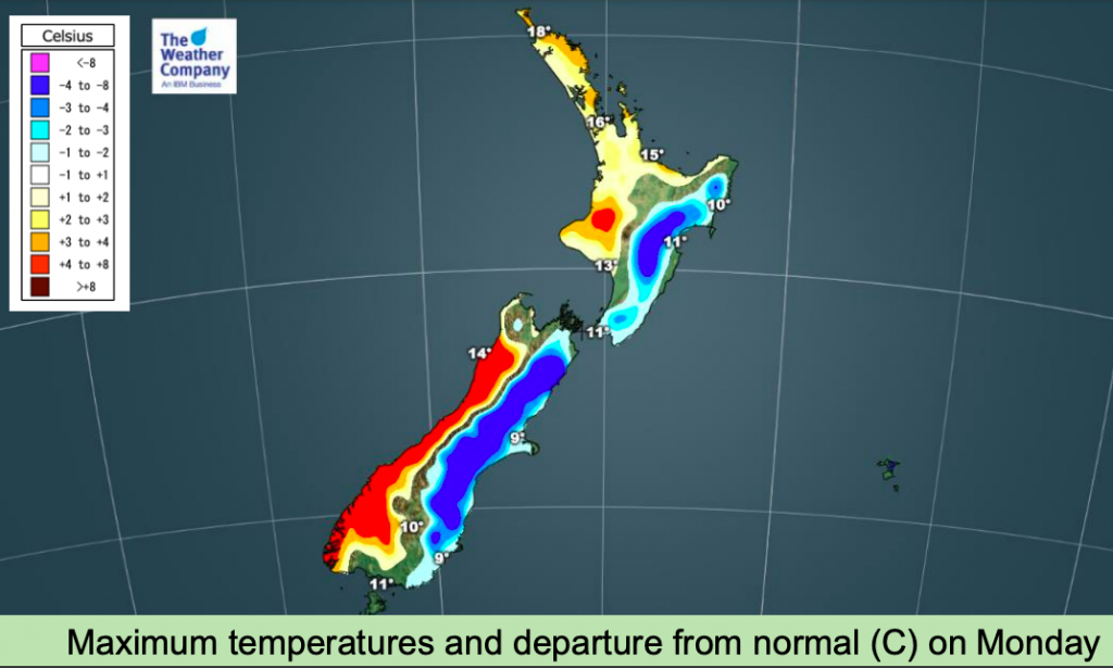
- Meanwhile, a cold front will pass over NZ Sunday night. Cool southerly winds trailing the cold front will produce moderate to locally heavy rain across the east coast of both the North and South Island on Monday.
- Rain will turn to snow from Sunday night across wide areas of mid to high elevation South Island and high elevation areas of the North Island.
- Total rainfall amount will be 30 mm across Gisborne and Hawke’s Bay.
- Snowfall amount will be 5-10 cm at most.
- Temperatures will be above to well above normal across western side of New Zealand this weekend. Readings will drop cooler from Sunday night to middle of the next week across eastern side of the country after passage of the cold front, while the West Coast will experience warmer than normal highs


AUSTRALIA:
- Low pressure off the south of SA produces light to moderate rain across coastal parts of SA and VIC Saturday.
- Southern coast of WA also receives light showers due to onshore flow behind the low pressure.
- As the low moves southeastward, rain will shift to VIC and TAS on Sunday and remain over TAS until Monday.
- Snow will occur across the alpine region and high elevation areas of TAS.
- A cold front will produce light showers across the southwestern corner of WA Sunday.
- The front will move eastward to produce moderate to locally heavy rain with gusts across TAS Tuesday. Combined with rain lasting from Sunday, TAS will receive 30 mm of total rainfall till Tuesday and 90 km/h to locally 100 km/h of wind gusts on Tuesday.
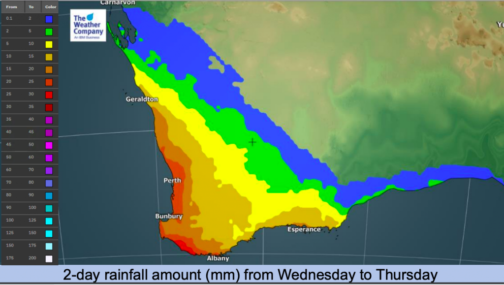
- Another strong cold front will hit WA with heavy rain and gusts Wednesday. 30-50 mm of total rainfall and 70 km to locally 100 km of wind gusts are expected across southwestern WA. The storm will move eastward through late of the next week.
- To the north, a trough will produce light to moderate showers with isolated thunderstorms across coastal portions of QLD from Sunday to Tuesday. Total rainfall amount will be 30-50 mm with locally more around Northern QLD.
- Temperatures will generally increase toward next week. Meanwhile, portions of the southeast coast will experience cooler than normal readings this weekend and overnight lows will be well below normal across SA and WA Saturday.


WeatherWatch.co.nz is proud to be an IBM / TWC business partner for New Zealand. If you’re a business and would like access to the World’s Most Accurate Weather Forecast data for your commercial solutions, please use the Contact form and we’ll be in touch. No matter how small or how large your organisation is, the power of IBM Watson means WeatherWatch.co.nz has a tailored solution for you.
Comments
Before you add a new comment, take note this story was published on 27 Aug 2021.


Add new comment