First cyclone of 2023 forms. North Islanders to have more severe weather this week, then improves
6/01/2023 11:07pm

> From the WeatherWatch archives
Story written on Saturday, since then the tropical depression has been named Tropical Cyclone Hale.
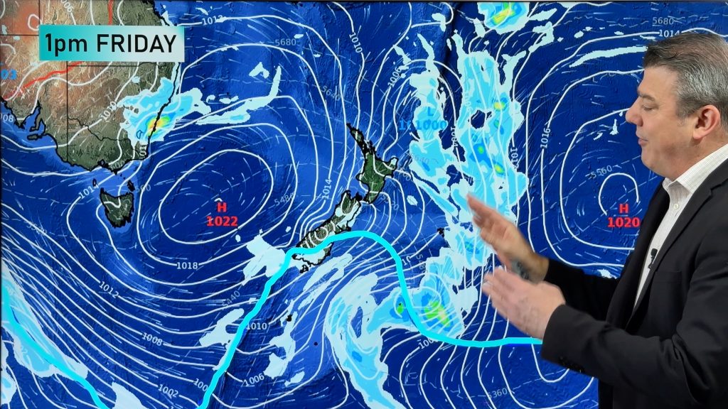
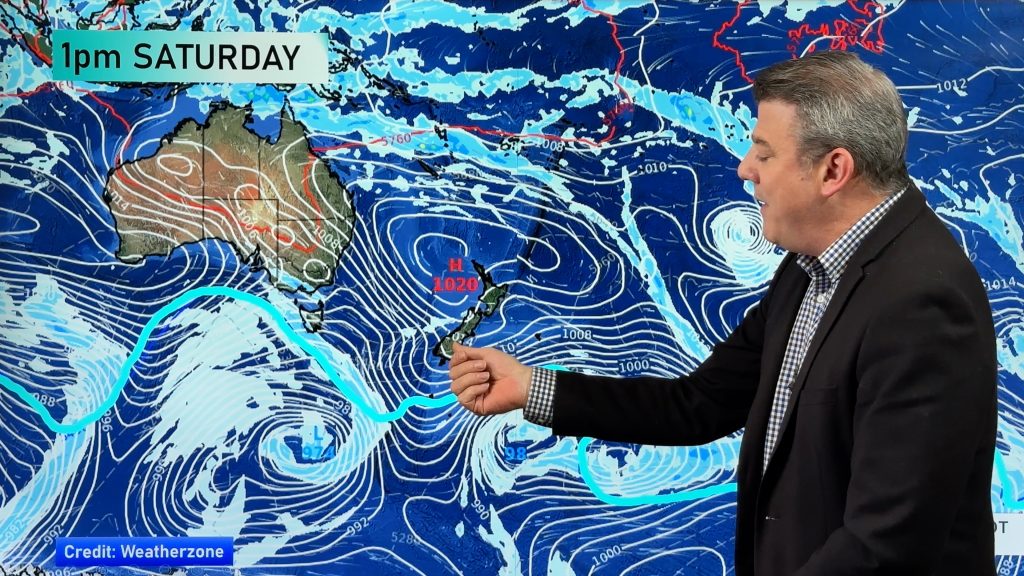
The remnants of a tropical depression may feed into a new area of low pressure near NZ next week bringing a new period of wind and rain to the North Island.
It’s a messy set up with a lot of disorganised low pressure (‘disorganised’ meaning lows that don’t look circular and seem messy in their design, not spinning properly, tricky to forecast movement etc). However next week this area of low pressure may merge into a storm near NZ (‘Storm’ criteria meaning gales all the way around the centre).
Either way – put simply – there is another period of unsettled weather for the North Island this coming week, mostly around Tuesday and Wednesday, due to a deepening low developing on NZ’s front door step. Precise tracking is NOT yet locked in, but we have the latest maps below for you to see current thinking.
Today the JTWC (US Joint Typhoon Warning Center) announced a tropical storm had formed far away in the Coral Sea. However it’s up to Australia’s BoM or Fiji MetService to officially name it – neither have done so at the time we published and didn’t indicate they weren’t going to today. The low may not really kick into an official tropical cyclone – but may well end up still pulling tropical energy down towards the NZ area to add more fuel to our weather. It’s unrelated to our weather today – but may not be by mid next week.
Various reliable computer modelling continues to get more aligned, showing a period of rain and wind for the North Island early to mid next week. Some trustworthy modelling shows the deep low pulling to NZ’s east, whilst two other reliable models show it directly affecting the North Island due to blocking high pressure to our east.
Unlike the severe weather event the North Island has just had, this one should move through a little faster – within 48 hours and likely clearing NZ by Thursday. However if it directly hits the island then we can expect pockets of severe weather across the island, not just in one zone to the north.
Journalists – please note – we are not currently forecasting a tropical cyclone to hit NZ, but our weather next week may well be connected to tropical low pressure.
There is still a chance this system could slide just east of us and not cause too many headaches for NZ – but as you can see below, there’s enough data to suggest those in the North Island should be aware of what is potentially developing.
WIND
Windiest weather looks to be at various places around the North Island on Tuesday and Wednesday (unlike the squash zone wind event we just had that brought gusty winds from one direction to mostly one part of the island for days, this system can bring various wind directions to many different regions within 48 hours). Eastern areas, like Gisborne, Hawke’s Bay, BoP and Coromandel Peninsula may be most impacted. Keep an eye on the wind maps here.

Red = gale force winds, Darker red = damaging winds.


RAIN
Much of the North Island gets rain – with heaviest rain showing in this map below. This may still move around a bit because the computer modelling isn’t totally aligned.
Our rain accumulation maps currently show Coromandel Peninsula, parts of BoP but especially East Cape, Gisborne and Hawke’s Bay most exposed to rain from this event next week.
LOCAL ESTIMATES – We suggest you use RuralWeather.co.nz or the daily rainfall totals at WeatherWatch.co.nz to work out specific numbers where you are. These local estimates are UPDATED HOURLY.

CONFUSED?
Just use your local RuralWeather.co.nz and WeatherWatch.co.nz forecasts – the IBM Watson supercomputer we use looks at all global weather modelling and crunches it into the most likely forecast for where you are, so you don’t need to bother with all the maps and models, unless you want to get your head around WHY this rain is coming in. IBM also learns from previous lows and wind/rain events to always continually fine tune the forecasts.
GOOD NEWS!
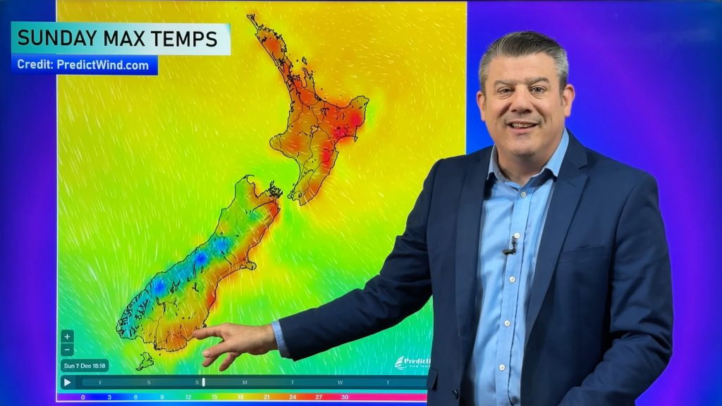
After this low next week WeatherWatch.co.nz is forecasting high pressure to return and a more settled, sunny, summer-like spell of weather for the country. Summer is not done yet! We expect more high pressure to cross NZ for the rest of January (with a few afternoon downpours in the mix). The tropics is very active though – and those who like watching for cyclones should be monitoring conditions between Australia and Fiji, in particular over the next couple of weeks.

WeatherWatch.co.nz / RuralWeather.co.nz
Comments
Before you add a new comment, take note this story was published on 6 Jan 2023.


Add new comment
Mat on 7/01/2023 8:37am
Finally made it to NZ after 11 years. Always our go-to for forecasts. We are currently baking on the West Coast of South Island. We have managed to avoid the bad weather in the north thanks to you guys. You have helped us turn our trip into one of blue skies and warm nights instead of wind and rain in the north. Good news about the next few weeks too! Thank you so much for all that you do.
Reply
Gavin on 7/01/2023 4:13am
Nobody likes looking for Cyclones
Reply
WW Forecast Team on 7/01/2023 6:19am
You’d be very surprised how many people like looking for cyclones!
– WW
Reply
Kingsley on 7/01/2023 1:44am
Settled weather…just in time for everyone to be back at work!
Reply