No video again today, but here’s what we would’ve talked about!
17/10/2018 7:46pm

> From the WeatherWatch archives
Our studio is still temporarily out of action as we upgrade a few things but thankfully the quiet weather means there really isn’t a lot to update you on… although we do have Labour Weekend fast approaching, so here’s the latest for that and the following week too.
THURSDAY/FRIDAY:
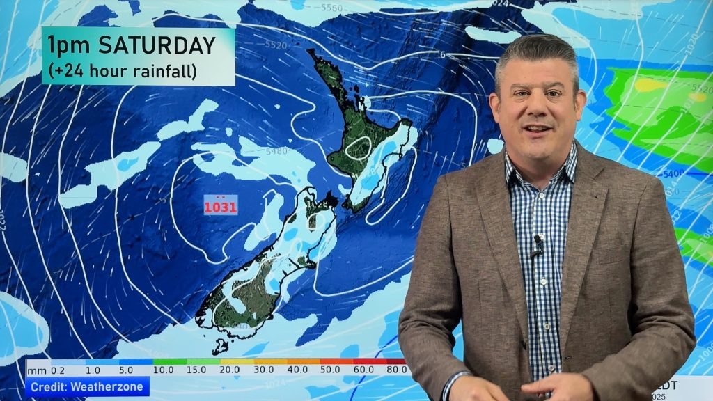
The enormous high in the Tasman Sea will today move in to the North Island, so it will be centred over Auckland by Friday. Apart from a couple of showers on the West Coast most places are dry and warm by Friday.
SATURDAY:
High pressure remains firmly in charge of New Zealand’s weather, bringing calm conditions to much of the North Island and warmer than average N to NW winds around the lower South Island. This may also encourage a bit of rain around Fiordland and perhaps a few spits/showers over some parts of Southland, along with cloud cover at times.
SUNDAY:
Sunday is similar to Saturday but a very weak front may bring in a few late showers to coastal Otago, otherwise dry.
LABOUR DAY MONDAY:
Calm under high pressure with a few afternoon downpours popping up around the southern ranges of both islands, otherwise dry and settled.
NEXT WEEK:
The high departs the South Island by Wednesday bringing rain back to the West Coast and westerly winds. The high departs the North Island by Thursday allowing showers to move in to the western side of the island for a time. A chance for more rain or showers next weekend too.
*We aim to have our videos back by noon Friday
– Written by head forecaster Philip Duncan
Comments
Before you add a new comment, take note this story was published on 17 Oct 2018.


Add new comment