Next few days: Sun, rain, snow, wind, warm, big swells, cold, calm, frosty (+7 Maps to explain!)
1/09/2018 1:10am

> From the WeatherWatch archives
Spring is here! Welcome to an even more unsettled weather pattern with the next few days being a perfect example.
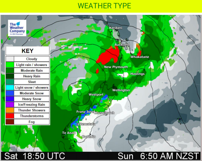
After a foggy morning for some the sun has now come out in many parts of NZ – but a few showers and cloudy areas to dot the western side of the upper North Island and may briefly affect Auckland and Northland. There have been some large cloudy spells in Christchurch and Dunedin too.
In a nut shell Saturday is a mild day, Sunday gets windier and wetter but also stays mild for most, but will cool down later. This weekend is warmer than average in a number of regions, by a few to several degrees. It’s possible eastern parts of the North Island (like Hawke’s Bay) may reach 20 degrees.
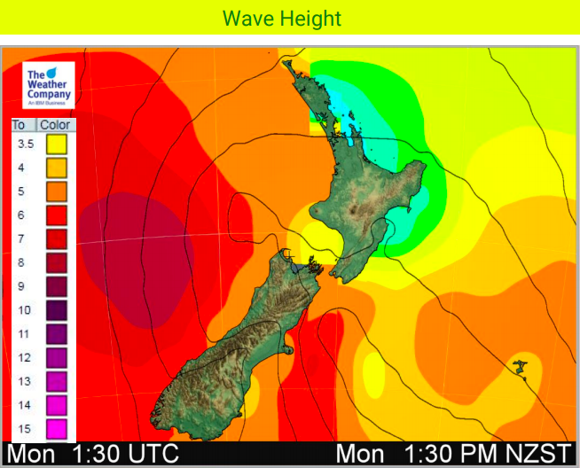
A deep low will also drive in big seas around western NZ.
By Monday the cooler change sweeps nationwide and lingers for a couple of days before high pressure rolls in from the west, taking until the end of next week to reach the eastern North Island.
HIGHLIGHTS:
- A front will move across New Zealand on early Sunday, so western parts of both islands will have a period of heavy rain. An isolated thunderstorm is possible too.
- Following the front, a deepening low will move across the South Island during Sunday and Monday, with heavy rain, snow (along the mountains) and strong southerlies over a large part of the South Island.
- Additionally, the low is also expected to bring strong, cold, southerly winds over the South island.
- On Tuesday and Wednesday, the low on east of New Zealand, should move slowly away northeastward from the country with a rain cloud.
- Frosts possible mid to late week in sheltered inland areas
- Mild again by next weekend for many but next week looks cooler.


– WeatherWatch.co.nz
Comments
Before you add a new comment, take note this story was published on 1 Sep 2018.
Latest Video

Low pressure moving in for end of 2025
Low pressure looks to be driving New Zealand’s weather more as we enter the final 7 days of 2025. For…
Related Articles
Low pressure moving in for end of 2025
Low pressure looks to be driving New Zealand’s weather more as we enter the final 7 days of 2025. For…
Santa Tracker 2025!
We’ve switched off the live Santa Tracker, displaying the final image at 11pm Christmas Eve. Comments posted after 11pm Christmas…

Weather for Christmas & NYE: The good, the bad and the ugly…
Low pressure, windy weather, hot and cold – it’s all in the mix over the coming days, bringing both hot…


Add new comment