> From the WeatherWatch archives
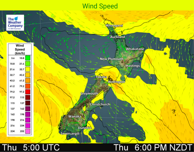
A weakening frontal system is moving up the South Island today while a sub-tropical low brings some rain to Northland today and is also weakening. In between it’s calm, dry and fairly sunny.
Locally heavy rain is expected on the southwestern side of the South Island today with some snow accumulation also likely in the mountainous areas. Winds are forecast to strengthen around the front and high waves from the southwest will expand around the South Island on Thursday too. This front is forecast to gradually weaken but showers may continue in some parts of the South Island on Friday here and there.
At the other end of NZ today the low pressure system to the north of the North Island will bring some rain to Northland and also locally a chance of heavy rain to the Far North or Bay of Islands. The low moves away tomorrow and conditions turn dry again.
Max temperature are expected to be higher than normal in most of the country across Thursday and Friday, continuing this trend we’ve seen a lot over 2018.
Weather conditions tend to be drier, sunnier and calmer on Saturday as a large belt of high pressure builds over much of NZ but a few isolated showers will pop up here and there, especially in the afternoons.


– WeatherWatch.co.nz
Comments
Before you add a new comment, take note this story was published on 3 Oct 2018.


Add new comment