New week: Low pressure, showers, high pressure, frosts… & maybe a hint of La Niña (+7 Maps)
13/10/2024 4:59am

> From the WeatherWatch archives
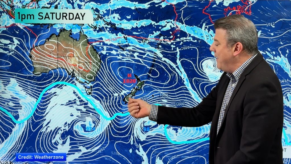
This week kicks off with low pressure hovering around the North Island and upper South Island, as a more wintry change comes into the south thanks to a large high pressure zone – bringing frosty weather this week to parts of the South Island.
Let’s get into the forecast for Monday to start with…
RAIN:
Patchy rain and showers are circling clockwise around the low pressure zone centred around central parts of the country. Wet weather is most likely in the upper South Island, north of Christchurch, and around the western North Island – although the low pressure zone means that rain and showers will pop up across the North Island. It’s dry in the lower South Island although some showers are possible tonight in the Deep South thanks to a weak cold front.
WIND:
Westerly quarter winds for much of the North Island on Monday, turning south to south-west at night for many. In the South Island easterly quarter winds turn more southerly – but lighter winds in the south of the island. Due to the low pressure zone moving east over NZ winds may be changeable.
TEMPERATURES:
Those light southern winds means frosts are possible this morning – and again in the nights ahead. The rest of the country is about normal although colder than normal weather is possible due to the colder air and cloud cover.
NEW WEEK AHEAD
On Tuesday that low drifts east of the North Island and strengthens – while a weaker secondary area of low pressure forms around the West Coast as a colder southerly feeds into the lower South Island. Southern and eastern parts of NZ have showers with drier windier sou-westers in northern NZ.
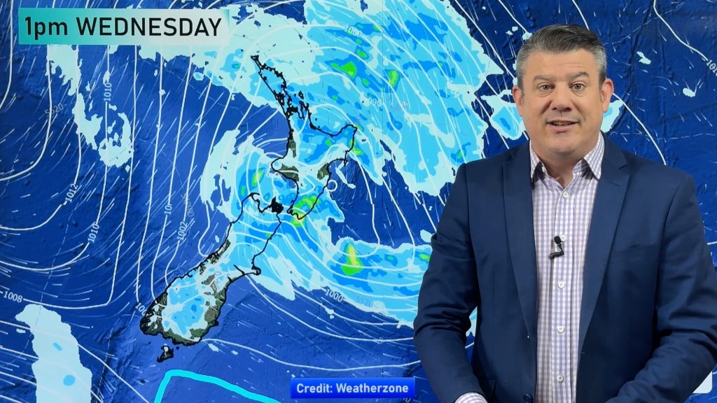
By Wednesday high pressure expands over the South Island bringing more frosty weather through many inland areas.This southerly flow feeds showers into the North Island.
Later in the week fairly weak low pressure in the Tasman Sea and strong high pressure east of New Zealand will produce a more La Nina like set up with easterlies in the north and some showers, but likely remaining drier further south.


Get free frost maps and paid hyper-local frost alerts (where you set the precise temperature criteria) via the WeatherWatch App, which is FREE to download.
Comments
Before you add a new comment, take note this story was published on 13 Oct 2024.
Latest Video
Hot & dry for many + Tropical Cyclone potential next week near Solomons/Vanuatu
The first tropical cyclone of the South Pacific Cyclone season may be forming next week well north of NZ with…
Related Articles
Hot & dry for many + Tropical Cyclone potential next week near Solomons/Vanuatu
The first tropical cyclone of the South Pacific Cyclone season may be forming next week well north of NZ with…
Drier weather returning, warmer too + some tropical trouble brewing
High pressure is moving closer to NZ today, pushing away yesterday’s downpours and thunderstorms well offshore east of the country,…
Large low today, hit & miss downpours / thunderstorms + your weekend outlook
A large low pressure system is bringing unstable weather conditions to most of the North Island today, resulting in downpours,…


Add new comment
Charmaine on 14/10/2024 4:36am
Wow this weather is really bad it’s supposed to be summer
Reply
WW Forecast Team on 14/10/2024 6:28am
Hi there. Summer doesn’t start for about two more months. If spring was like summer it wouldn’t be called spring 🙂
-WW
Reply