More serious tropical trouble potential for New Zealand later next week
6/04/2017 10:40pm

> From the WeatherWatch archives
A big high is rolling in across the country over the next few days but it’s not going to last – next week New Zealand faces rainmakers from both the tropics and the Tasman Sea as the much wetter than average weather pattern continues.
It’s a messy set up next week with another large low in the Tasman Sea coming towards New Zealand. Around Wednesday and Thursday it should start to bring in more widespread rain. It’s not as tropical as Debbie was, but rain may still be heavy and slow moving enough to cause issues.
However later next week towards Thursday and Good Friday there may be two tropical storms, or ex-cyclones, coming our way.
WeatherWatch.co.nz is fairly confident the one to the north west won’t directly hit New Zealand or bring severe weather but may bring increased swells to east coast beaches and added cloud, humidity and showers to the north of the country.
But the second possible cyclone may come directly towards New Zealand from the north to north west (from New Caledonia area). It’s too far out to lock in, but reliable computer models have been picking these storms to form for several days now and there does appear to be a zone around New Zealand suitable for at least two of these three lows to merge.
So next week is another serious week for New Zealand with the potential for more significant rain coming in and the risk of further slips and flooding.
Autumn is shaping up to be an extraordinarily wet season this year, especially for the North Island where most regions are now wetter than normal.

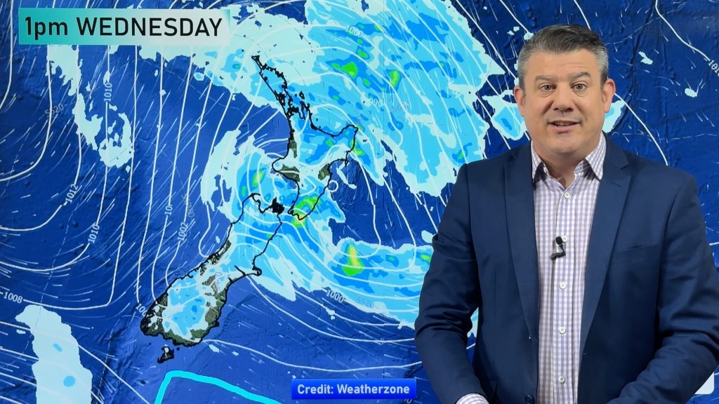
– Image above / Next Thursday before the Easter Weekend shows a large low in the Tasman Sea merging with a small but potent ex-Cyclone. This could be serious for areas already hit by flooding in the past month, but it’s too early to confirm if this outlook will unfold as the models suggest. Certainly one to keep an eye on.
 – Image – GFS (American) model shows over the next 7 days a wetter than average pattern (Blue) covers much of the North Island. It remains drier than average in Southland however.
– WeatherWatch.co.nz
Comments
Before you add a new comment, take note this story was published on 6 Apr 2017.


Add new comment
PJAG on 7/04/2017 7:12pm
Both the kids are away next weekend at EC17 in Feilding. It’s the first time they’ve EVER been away for four nights together, and the longest we’ve been away from them for 3 years. The bad Mom in me was really looking forward to a lazy weekend with hubby. And I want them to have an awesome time, not be stuck in a tent in the middle of a bog.
Reply
Guest on 7/04/2017 9:40am
Maybe we should all just have a long weekend at home ,
Why torture self hours in traffic – when you could just
Chill back n relax ! and if this weather continues… It’ll be safer too to just no go anywhere !
Reply
mvgsmf on 6/04/2017 11:06pm
How does this summer/autumn compare to previous?
Just about ready to slit my wrists over this hideous non stop, heavy weekly rain events – its like 10 months of winter!
Reply
WW Forecast Team on 6/04/2017 11:30pm
Hi there, don’t do it, the sun is coming out this weekend!! 🙂 More heavy rain later next week though – we’re just in a pattern which is proving hard to shake. Definitely records are being broken, wetter than average in many/most North Island regions now. As for previous years you’d need to ask NIWA as they commercialise all public data and will not share with us (Which is why the Government is now officially investigating this, as all taxpayers own the data so all should have free and open access to it). Definitely wetter than average now – but in between the big rain events at least we have sun and brief high pressure systems too – a slight silver lining!
Cheers
WW
Reply