> From the WeatherWatch archives
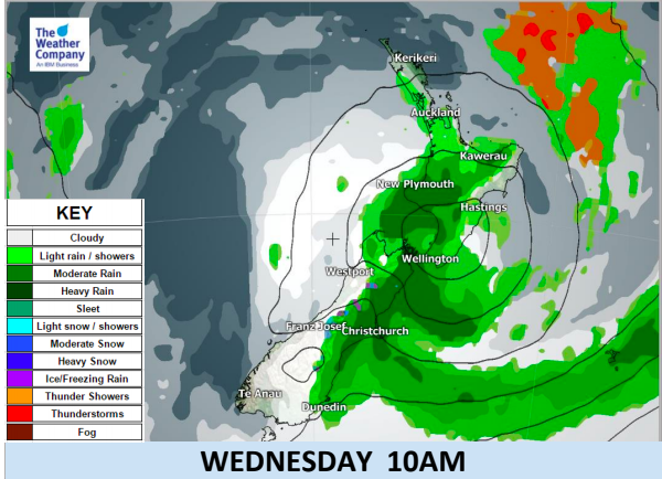
A sub-tropical low is moving into the north eastern North Island and should make landfall somewhere in the eastern Bay of Plenty around noon. The low has already peaked in strength and will gradually weaken over the next couple of days as it tracks southwards down New Zealand and into high pressure.
Winds will remain strong to gale in the main squash zone of air pressure between this low and the high – mainly as windy sou’easters through central New Zealand / Cook Strait area.
Main Highlights:
- An intense low is currently located over Bay of Plenty and is about to move southward across the eastern side of the North Island.
- Strong persistent winds and isolated heavy rain with higher wind gusts are expected on Tuesday mainly in the eastern part of the island.
- There are multiple fractured rain bands located to the south and west of the low pressure center. Short duration rainfall about 10-20 mm/h may occur along the rain band. One of these rain bands will affect the southeastern part of the North Island until this evening. The heavy rainfall will be localised over the eastern side of the ranges. Isolated flooding is possible.
- Moderate amounts of rain are expected on western side of the North Island, except for Taranaki, where a pulse of heavy rain may occur during Tuesday night.
- Heavy rain accumulation is also expected in Marlborough and Kaikoura coast from Tuesday afternoon
- to Wednesday morning. Higher up snow accumulation of about 10cm is also likely over the Kaikoura Ranges.
- The rain and winds will ease after Wednesday morning as the low pressure moves southeastward away from the eastern coastline of New Zealand with a calmer, drier, Thursday and Friday for most.


– WeatherWatch.co.nz
Comments
Before you add a new comment, take note this story was published on 11 Jun 2018.


Add new comment