> From the WeatherWatch archives
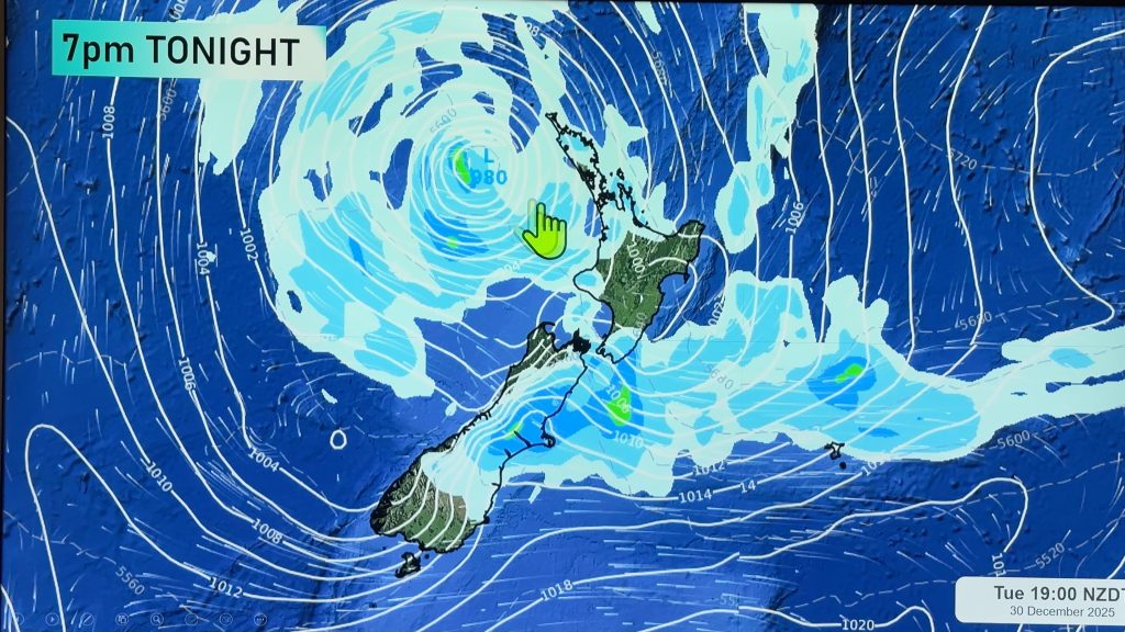
A frontal feature pushes over the North Island on Wednesday morning, weakening as it goes coming in from the west. Later in the day a northerly quarter airflow strengthens, a very vigorous front moves onto the South Island overnight bringing very heavy rain.
Sunny spells for Northland and Auckland, chance of a shower otherwise mainly dry. The Waikato and Bay Of Plenty sees showers develop late morning then clearing later in the afternoon. West to northwesterly winds.
Lower western North Island. Early morning rain with heavy falls, thunderstorms and hail possible then gradually easing and clearing in the evening. Some sun breaking through at times by midday. Snow above 1000m. West to northwesterly winds.
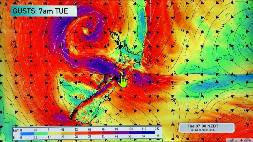
Morning cloud with a few spots of rain possible along the east coast then breaking away in the afternoon to some sun, northwesterly winds. Early rain for Wellington then mainly dry with some sun, further rain moves in overnight. Northwesterlies rise to gale force overnight.
Any early rain clears about Nelson / Marlborough then becoming mostly sunny, overnight some rain pushes in from the west. Heavy falls overnight about Tasman / northwest Nelson. North to northwesterly winds.
Morning cloud for Canterbury with the risk of a shower then sunny areas develop, high cloud thickens later in the day. Overnight heavy rain develops about the high country with thunderstorms, spots of rain spread elsewhere for a time. North to northeasterly winds strengthen later in the day, gales possible overnight Banks Peninsula northwards.
Morning showers clear along the West Coast, remaining fairly cloudy then later in the evening / overnight rain moves in with heavy falls and thunderstorms. Rain may be torrential at times overnight. Northerly quarter winds strengthen from afternoon with gales developing about coastal fringes in the evening.
Mostly sunny about Southland and Otago with high cloud increasing from afternoon, overnight spots of rain. Northeasterly winds freshen, becoming strong about the Otago coast in the evening.
Blue – Heavy form of precipitation or cold temperatures, typically below 1 to 2 degrees celsius.
White – Snow
Purple – Strong winds.
Yellow – Temperatures around the mid 20 degree mark or over.

Not all regions and towns have been mentioned above. For specific 10 day information for your city, town, rural community or island please see the 1500 forecasts on our homepage!
– Aaron Wilkinson, WeatherWatch.co.nz
Comments
Before you add a new comment, take note this story was published on 15 Aug 2017.


Add new comment