> From the WeatherWatch archives
A strong southwesterly airflow eases later on Wednesday as a large anticyclone lies over much of Australia and into the Tasman Sea.
A few showers for the upper North Island, mainly morning then becoming drier from afternoon with some sun breaking through. Brisk to strong southwesterly winds ease later in the day, a risk of gales near the coast.
Showers for the lower North Island in the west (snow flurries to 600m about the Central Plateau) ease then clear by midday, sunny spells then gradually increase. Cold southwesterly winds (strong about coastal Taranaki) die out at night.
Early showers clear along the East Coast then expect cloudy areas and sunny spells, a few showers cling to coastal Wairarapa (clearing at night) and then moving into Gisborne again later in the evening. Any shower activity may bring a few snow flurries to 500m, it will be a very small amount though and may not settle. Brisk to strong southwesterly winds, gales about coastal fringes.
Mostly cloudy for Wellington, early showers clear, a shower or two may return late afternoon / evening in the east. If there is any shower activity there may be a few snow flurries to 500m however it will be quite minimal. Strong to gale southerly winds.
Becoming sunny early in the morning about Nelson and Marlborough, brisk to strong southwesterly winds die out in the evening.
Canterbury, showers about the coast / Banks Peninsula ease in the morning and clearing for the most part around midday although the odd one may remain about the outer Peninsula till evening. The odd snow flurry to 400m. Inland areas see sunny spells from morning then mainly sunny by midday, sunny spells start to break through near the coast midday onwards. Strong southwesterly winds (gale to severe gale about the coast / Banks Peninsula in particular) dying out overnight.
Sunny or becoming sunny early in the morning for the West Coast, breezy cool southwesterly winds ease during the day, dying out in the evening. Early showers / snow flurries about Southland and Otago to 400m clear then sunny spells increase, breezy southwesterlies strong about the coast die out in the afternoon. Winds and cloud not dying out / breaking about the Otago coast till evening.
Overnight frosty conditions develop for many regions away from the coast for the North and South Islands.
Blue – Heavy form of precipitation or cold temperatures, typically below 1 to 2 degrees celsius.
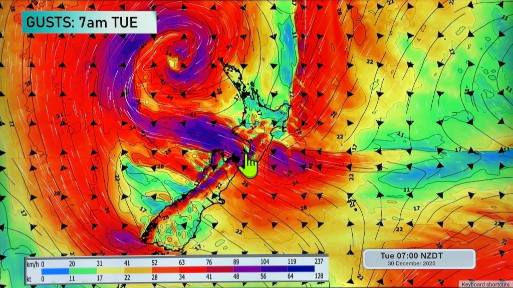
Purple – Strong winds.
Yellow – Temperatures around the mid 20 degree mark or over.

Not all regions and towns have been mentioned above. For specific 10 day information for your city, town, rural community or island please see the 1500 forecasts on our homepage!
– Aaron Wilkinson, WeatherWatch.co.nz
Comments
Before you add a new comment, take note this story was published on 13 Jun 2017.


Add new comment