> From the WeatherWatch archives
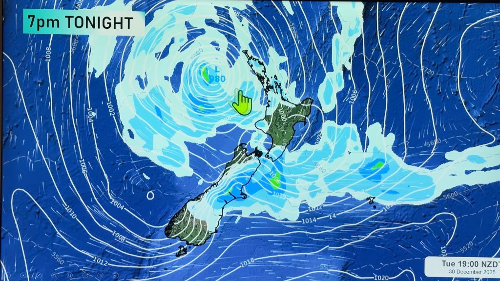
A deep low which was once ex tropical cyclone Debbie moves towards the western side of the North Island on Wednesday. With it comes some very unsettled weather with heavy rain, strong winds and perhaps even a few thunderstorms with the low risk of a small tornado for the western North Island.
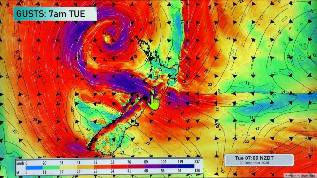
For the upper North Island we see heavy rain for many regions, torrential downpours especially about Taranaki across to the Bay Of Plenty. Thunderstorms are possible afternoon and evening for the upper half and western side of the North Island, with any thunderstorms there is the low risk of an isolated tornado. Winds generally gusty from the north then changing to the northwest overnight, northwest winds may rise to gale about western coastlines.
Rain for the lower North Island may be heavy, winds strong from the east or southeast, gales likely through Cook Strait with severe gales even possible then easing in the evening. Gisborne doesn’t look to see heavy rain although areas of rain or showers are likely, gusty northerlies develop overnight for Gisborne / Hawkes Bay.
For the upper South Island we see areas of heavy rain slowly move southwards during the day, first affecting Nelson and Marlborough then moving into North Canterbury by midday. Reaching Mid / South Canterbury in the evening or perhaps not till overnight. Rain will likely be about much of the South Island’s east coast all day long, the section above is describing the heaviest rain and how it will track during the day. Rain about Nelson and Marlborough should ease overnight.
Winds about the upper South Island will be strong from the southeast, severe gales possible about northern Tasman and the Marlborough Sounds. Overnight strong southwesterlies develop about eastern coastal fringes of the South Island with gales possible by dawn on Thursday about Banks Peninsula.
Coatal Otago is cloudy all day long with drizzle then rain in the evening, Central Otago sees sunny spells and increasing cloud with drizzle or a few showers from evening. Southland has a mix of sun and cloud, cloud thickens from afternoon.
Rain about Buller gradually spreading southwards reaching the Glaciers overnight, winds pick up and become gusty from the southeast. Fiordland and South Westland have a mainly sunny day with high cloud.
Blue – Heavy form of precipitation.
Purple – Strong winds.
Yellow – Temperatures around the mid 20 degree mark or over.

Not all regions and towns have been mentioned above. For specific 10 day information for your city, town, rural community or island please see the 1500 forecasts on our homepage!
– Aaron Wilkinson, WeatherWatch.co.nz
Comments
Before you add a new comment, take note this story was published on 4 Apr 2017.


Add new comment