> From the WeatherWatch archives
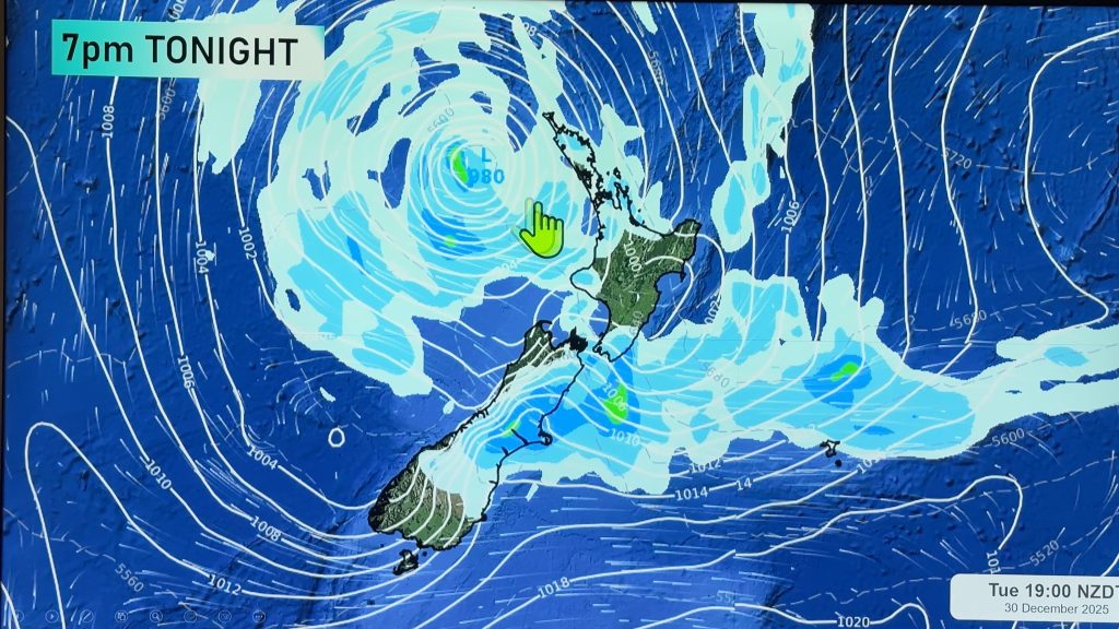
A ridge lies over the South Island on Monday drawing in a southerly quarter airflow meanwhile a front stretching out from a low in the Tasman Sea affects the lower North Island. A humid subtropical northerly for the upper North Island.
A mix of sun and cloud about Auckland, cloud builds with a few showers possible in the afternoon, humid warm northerlies with temperatures reaching into the mid 20’s. Waikato southwards starts to become a bit cloudier with showers or drizzle moving in by midday, south of about Lake Taupo rain moves in during the evening with heavy falls possible, this band of rain slips a little further southwards as the night goes along moving onto the upper South Island.
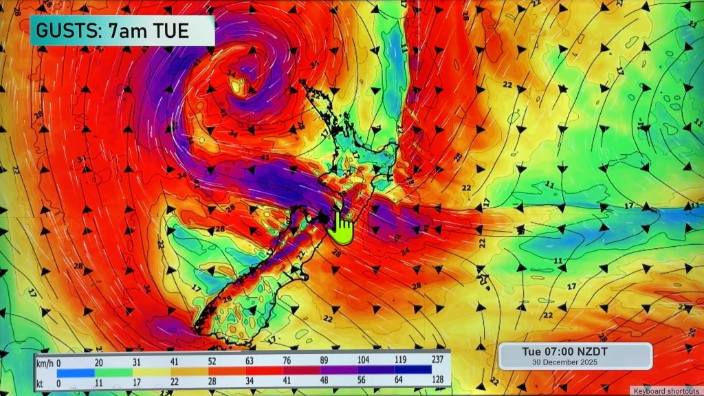
Winds about the lower North Island and upper South Island freshening from the south or southeast during the day.
Cloudy for the east coast of the South Island with a few drizzle patches now and then, winds cool from the south or southeast however an afternoon northeasterly may pop up between Otago Peninsula and South Canterbury.
Southland is fairly cloudy with the odd shower or drizzle patch, southerly winds develop by midday.
The West Coast sees mainly dry conditions with plenty of thick high cloud, just Fiordland breaks through and has a mainly sunny day.
Blue – Heavy form of precipitation.
Purple – Strong winds.
Yellow – Temperatures around the mid 20 degree mark or over.

Not all regions and towns have been mentioned above. For specific 10 day information for your city, town, rural community or island please see the 1500 forecasts on our homepage!
– Aaron Wilkinson, WeatherWatch.co.nz
Comments
Before you add a new comment, take note this story was published on 2 Apr 2017.


Add new comment