> From the WeatherWatch archives
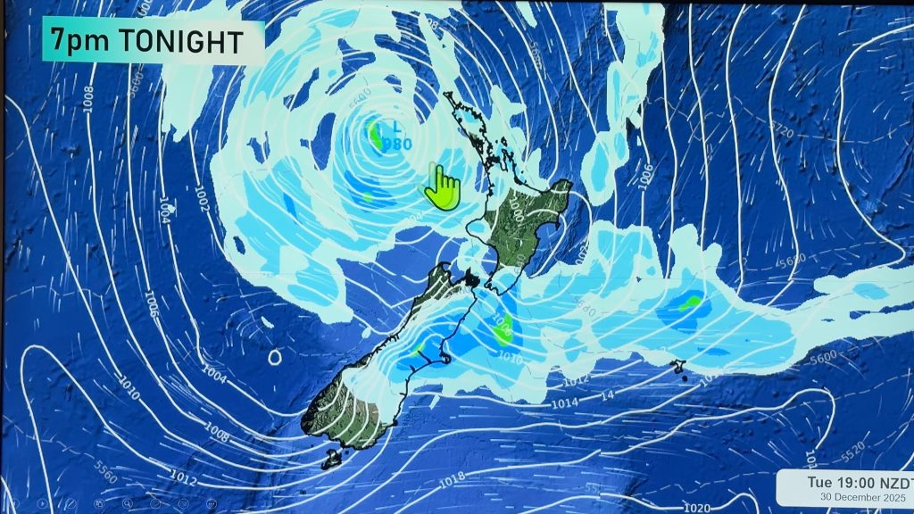
A northwesterly airflow builds over New Zealand on Monday then a front coming in from the southwest hits the lower South Island late afternoon / evening bringing in a cold change.
A mostly cloudy day for the western North Island on Monday, there may be a light shower or two about also otherwise mainly dry. Further east conditions are sunnier.
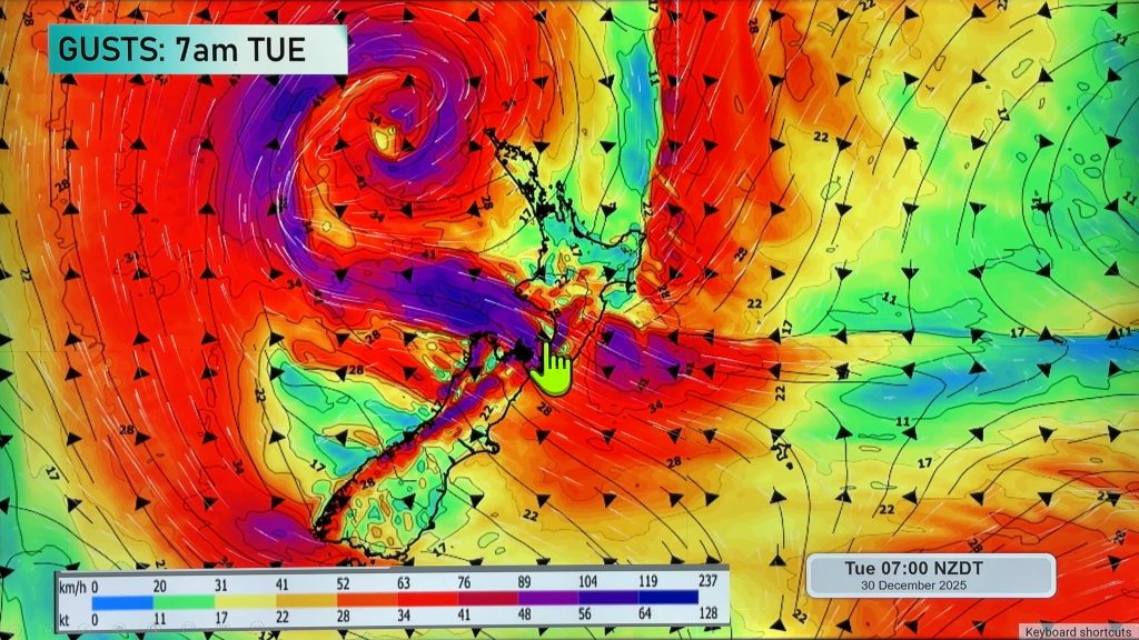
Northwesterlies build during the day through Cook Strait however it’s not till evening / overnight that winds start to become strong with a risk of gales. The same applies for the upper South Island about inland areas.
For the South Island’s West Coast expect showers or drizzle, turning to rain about South Westland in the afternoon with the odd heavy fall making an appearance then easing overnight. Areas of heavy rain move north in the evening. The east coast can expect a mainly dry day with high cloud, winds from the northwest and a mild afternoon for some reaching into the high teens.
A southwest change moves into Southland late afternoon then Otago in the evening bringing rain, as the change pushes northwards overnight it loses steam and may only bring a few showers to Canterbury.
Blue – Heavy form of precipitation or cold temperatures, typically below 1 to 2 degrees celsius.
Purple – Strong winds.
Yellow – Temperatures around the mid 20 degree mark or over.

Not all regions and towns have been mentioned above. For specific 10 day information for your city, town, rural community or island please see the 1500 forecasts on our homepage!
– Aaron Wilkinson, WeatherWatch.co.nz
Comments
Before you add a new comment, take note this story was published on 11 Jun 2017.


Add new comment