> From the WeatherWatch archives
A southwesterly airflow weakens over the country tomorrow while high pressure pushes in from the Tasman Sea, a weak front moves onto the lower South Island in the afternoon.
For much of the North Island expect a few morning showers then sunny spells increasing, winds cool from the southwest but easing later in the day. The odd shower may linger a little longer in the day about Auckland and Northland. Wellington is mainly sunny after any morning cloud clears, southerly winds ease.
Southwesterlies about the Wairarapa may be strong but they will ease during the day.
The South Island has mainly sunny conditions, any early cloud along the east coast Canterbury northwards clears away with easing southwesterly winds. There may be a touch of frost to start the day for some inland areas, if not it will be a cold night ahead anyway that’s for sure.
From afternoon a southwesterly airflow develops about Southland bringing some cloud and a few patchy showers or areas of drizzle, this moves into Otago by evening then into Canterbury overnight or towards dawn on Saturday.
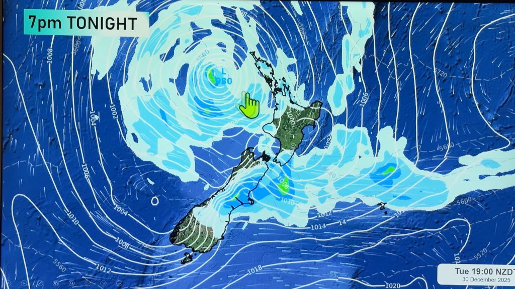
Blue – Heavy form of precipitation.
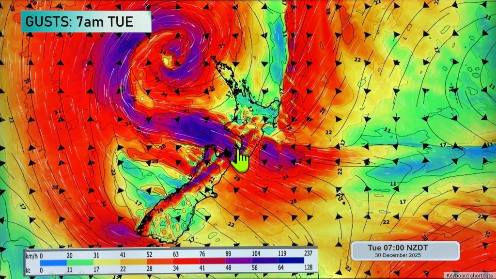
Purple – Strong winds.
Yellow – Temperatures around the mid 20 degree mark or over.

Not all regions and towns have been mentioned above. For specific 10 day information for your city, town, rural community or island please see the 1500 forecasts on our homepage!
– Aaron Wilkinson, WeatherWatch.co.nz
Comments
Before you add a new comment, take note this story was published on 6 Apr 2017.


Add new comment