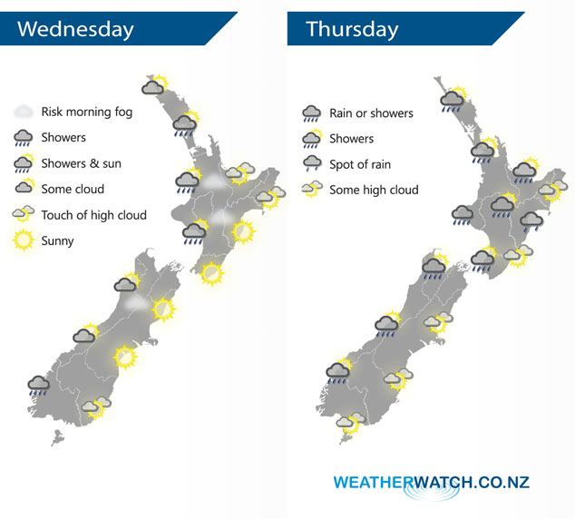
InfoGraphic: The Big Picture for Wednesday / Thursday
17/07/2018 7:00pm

> From the WeatherWatch archives
A ridge hangs over New Zealand today bringing mainly settled weather, a few showers about however mainly for Auckland northwards and Fiordland. A front moves across the North Island on Thursday pushing in from the west, a calmer story for the South Island with morning rain or showers on the West Coast then clearing.
A bit drier today however there are still a few showers about, mainly about the western North Island and about Fiordland in the south. A mix of sun and cloud for western regions otherwise with some morning fog possible. Overnight some fog may develop again for inland North Island areas. Mainly sunny and dry weather in the east with light winds.
A front pushes over the North Island during Thursday moving in from the west bringing showers, some rain for a time during the afternoon / evening with a chance of heavy falls. Drier in the east with some high cloud however there may be a few spots of rain spread from the west late afternoon or evening. Morning showers clear then West Coast of the South Island then expect some sun, mostly sunny in the east with morning high cloud breaking away.

By Weather Analyst Aaron Wilkinson – WeatherWatch.co.nz
Comments
Before you add a new comment, take note this story was published on 17 Jul 2018.


Add new comment