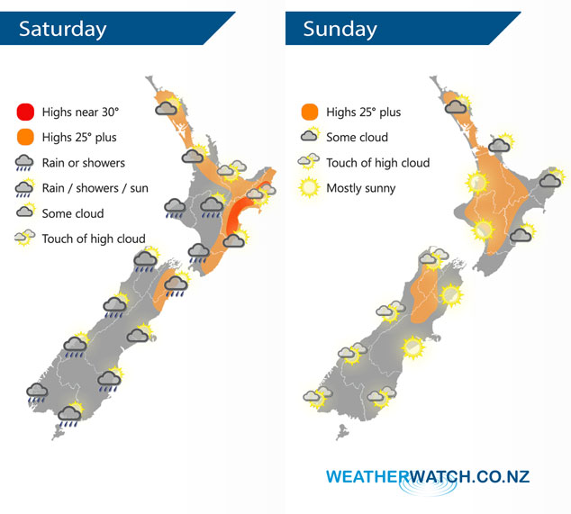
InfoGraphic: The Big Picture for Saturday / Sunday
28/02/2020 2:00am

> From the WeatherWatch archives
A front moves off the upper South Island and onto the lower North Island on Saturday morning, it will weaken quickly as it does then a ridge of high pressure pushes in from the Tasman Sea. An anticyclone covers the country on Sunday bringing settled weather.
Mainly dry for the northeast of the North Island on Saturday, some rain moves into the southwest during the morning then quickly easing to showers and mostly clearing away in the afternoon. A shower or two may linger into the evening for some. Showers activity for most South Island regions clears away by afternoon with sunny areas increasing, winds from the southwest east tending easterly in the afternoon for the east coast.
Mostly sunny weather for most of New Zealand on Sunday, light winds and afternoon sea breezes. Some coastal cloud for northeastern parts of the North Island. A touch of high cloud for the South Island.
By Weather Analyst Aaron Wilkinson – WeatherWatch.co.nz
Comments
Before you add a new comment, take note this story was published on 28 Feb 2020.


Add new comment