> From the WeatherWatch archives
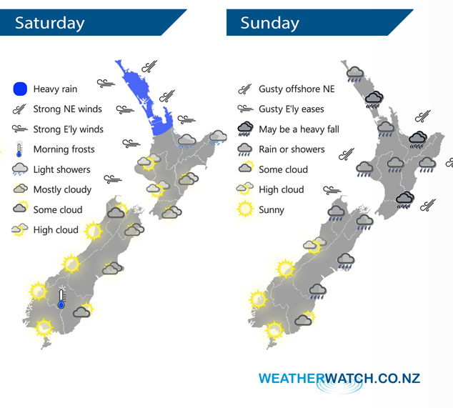
An east to northeasterly airflow lies over the country on Saturday with a front sweeping down over the upper North Island during the day. This front moves southwards over the lower North Island during Sunday while an easterly quarter airflow lies over the South Island. All the meanwhile a low churns away out in the Tasman Sea.
A front starts to sweep southwards over the upper North Island during Saturday, with this front comes some heavy rain and gusty east to northeasterly winds. The strongest winds will be mostly just offshore and about exposed eastern coastlines. Fairly cloudy elsewhere for eastern parts of New Zealand while out west is sunnier, some high cloud also possible especially for the lower North Islands western side.
Areas of rain for the North Island on Sunday may be heavy at times but mainly in isolated areas, mostly there will be a mix of showers and dry spells. A few showers for the upper and eastern South Island, showers south of about Banks Peninsula only develop later in the day. Meanwhile the West Coast has another great day.

By Weather Analyst Aaron Wilkinson – WeatherWatch.co.nz
Comments
Before you add a new comment, take note this story was published on 1 Jun 2018.


Add new comment