InfoGraphic: Severe Weather Highlights across NZ: Wed, Thu, Fri
11/04/2017 9:32pm

> From the WeatherWatch archives
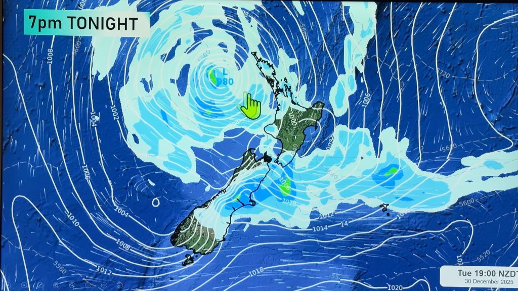
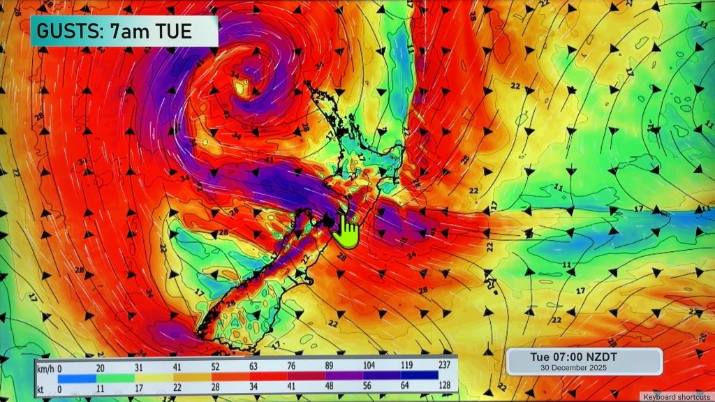
A low sits off to the west of the South Island today dragging in a humid east to northeasterly airflow over New Zealand. Northeasterlies continue on Thursday and we also see Cyclone Cook move onto northern New Zealand during the day then moving southwards down the country in the evening and overnight. Very strong winds and heavy rain will be associated with this low and the areas most affected will be determined by where this deep low moves. Ex Cyclone Cook moves southwards over the South Island on Friday while northwesterlies lie over the North Island.
Wednesday
Blue – Heavy rain about the upper South Island gradually eases from late afternoon. Rain about Otago and Southland may be heavy at times throughout the day, mainly coastal.
Rain this morning about Auckland may be heavy then easing from afternoon, heavy rain is possible about the Waikato this afternoon then easing in the evening. From afternoon expect heavy rain about the Bay Of Plenty.
Rain may be heavy about the western North Island from this afternoon then easing this evening.
Purple – Southeasterly winds strengthen about coastal parts of the lower South Island from afternoon.
Yellow – Afternoon high’s reaching into the mid 20’s about Northland.
Thursday
A very complicated graphic to describe, we have Cyclone Cook moving onto the north of the country during the afternoon then pushing southwards in the evening and overnight. With this strong low brings the potential for heavy rain (torrential falls for some) and very strong winds. Any subtle shift in the centre of this low could result in a very different outcome for various regions regarding rain and wind. However current indications are that most parts of the North Island could experience some heavy rain during the day, then the top of the South Island and eastern South Island overnight.
The most intense areas being Auckland, Waikato, Bay Of Plenty and perhaps parts of the Central North Island and northern Taranaki. These areas of very heavy rain will build in the afternoon then ease from evening. A risk of torrential falls and flooding is possible.
As noted above very strong winds are likely with this low. Winds will strengthen from the east in the afternoon about the upper North Island with severe to storm force gales possible about eastern areas then winds change around to the northwest in the evening once the low moves through. Northwest winds could be equally as strong for a time when the change kicks in then easing away fairly quickly. Very strong north to northeasterly winds push down the eastern side of the country during the evening and overnight, ahead of this strong southeasterly winds may build about coastal Canterbury overnight. Winds through Cook Strait could be very strong from the north for a time overnight.
Gusty southeasterly winds about coastal parts of the lower South Island ease away in the morning.
Friday
Blue – Heavy rain pushes southwards during the day along the east coast of the South Island, easing about Canterbury in the morning then about Otago and Southland late afternoon / evening. Some heavy rain at times about North Westland from morning then South Westland from afternoon. All heavy rain eases overnight.
Purple – Strong winds will mainly be limited to coastal fringes of the eastern South Island and may only be very strong for a relatively short amount of time as a deep low centre passes southwards during the day. Winds generally strong to gale from the south or southeast then changing to the north once the low moves by. Northerlies through Cook Strait will likely be gale force in the morning then easing by midday.

– Please note, the idea behind this update is to focus on the main weather highlights, which is why not all regions are mentioned.
For specific 10 day information for your city, town, rural community or island please see the 1500 forecasts on our homepage!
– Aaron Wilkinson, WeatherWatch.co.nz
Comments
Before you add a new comment, take note this story was published on 11 Apr 2017.


Add new comment
mvgsmf on 11/04/2017 7:43pm
Hi Guys -thanks for the great updates.
I know its an in-exact science but do you think the rain will be torrential between Auckland and Waitomo region early Thur afternoon or will it be a bit later on that it gets South?.
We’re taking off early at midday to drive from Auckland to Ruapehu and hoping we will be ahead of the worst stuff…
Cheers
Reply
WW Forecast Team on 11/04/2017 7:55pm
Hi there
I couldn’t say exactly sorry re the timings, please feel free to use these maps to scroll through the various times and it will give you an idea of when the heaviest rain is and where. Metservice warnings should be followed in addition to this of course.
http://www.weatherwatch.co.nz/forecast-maps/rain
Hope your trip goes well if you do go, I’d probably stay home in all fairness and go the next day if you can!
Cheers
WW
Reply