> From the WeatherWatch archives
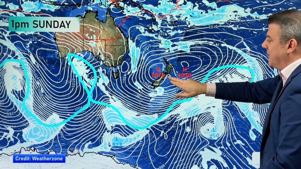
A ridge of high pressure is holding off our incoming sub tropical low system for another day. Expect a mainly settled day across the country although a few places will see showers, mainly the West Coast of the South Island and Northland.
Northland
Some morning rain eases to showers which become few and far between in the afternoon, a few sunny spells break through during the afternoon also. Easterly winds. Rain then moves in again overnight.
Highs: 16-17
Central North Island, Waikato, Bay Of Plenty & Auckland
Sunny spells and increasing cloudy areas with easterly winds. The odd isolated shower possible from afternoon onwards otherwise mainly dry.
Highs: 14-17
Eastern North Island
Sunny spells and some thickening high cloud, north to northeasterly winds. Rain moves into Gisborne overnight from the north.
Highs: 16
Western North Island
Sunny spells and some cloud with northerly winds tending southerly in the afternoon.
Highs: 16-17
Wellington
Early showers clear, sunny spells then gradually increase with the weather in the afternoon becoming mostly sunny. Breezy northerly winds ease in the evening.
High: 14
Nelson
Showers clear by mid morning, sunny spells increase in the afternoon with light winds tending northerly.
Highs: 15
Marlborough
Any early spots of rain clear, high cloud decreases during the morning then expect a mostly sunny afternoon. Light winds tend northerly or northwest.
Highs: 16-17
Canterbury
Cloudy periods with light southerly winds in the morning then tending northeast in the afternoon. There is the slightly risk of a drizzle patch about, mainly early morning.
Highs: 13-14
West Coast
Cloudy spells with the odd shower, light winds tend northeast.
High: 14
Otago
Mainly clear but plenty of high cloud, light winds tend northerly or northeast.
Highs: 10-11
Southland
Morning cloud clears to a mostly sunny afternoon, light winds tend northerly.
Highs: 11-12
WeatherWatch.co.nz
Comments
Before you add a new comment, take note this story was published on 8 Aug 2013.


Add new comment