Saturday Newsfeed: Extratropical cyclone brushes north-eastern North Island (+9 Maps)
20/07/2024 6:15am

> From the WeatherWatch archives
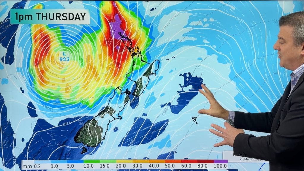
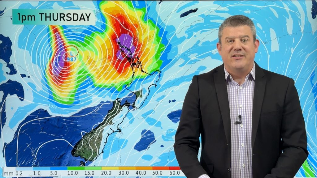
A low pressure zone peaked in power on Saturday as it tracked very near the north-eastern side of the North Island. The centre will remain offshore and is moving away now.
The storm formed rapidly overnight and is being described as a ‘weather bomb’ (technical name: bombogenesis, or explosive cyclogenesis) and this is when a low pressure system drops more than 24 hectoPascals in 24 hours. In simple speak: The air pressure drops fast and a storm forms within a day.
It’s also known as an extratropical cyclone (or mid latitude cyclone) and means this storm has formed outside of the tropics with gale force winds around the centre. However extratropical cyclones don’t have a warm core like a tropical cyclone does – and it’s this colder setup that means they behave differently to tropical cyclones. But in a general sense they look very similar in satellite and isobaric maps – and can produce equally damaging winds.
Rain in extratropical cyclones is often more broken up than tropical cyclones, and usually often only covers half or even just one quarter of the entire low pressure zone. Tropical cyclones usually have rain around the entire centre – the full 360 degrees.
The air pressure in this storm on Saturday morning was only slightly higher than Cyclone Gabrielle last year – which was 965hPa – but overall this storm isn’t as powerful as Gabrielle and certainly doesn’t pose anywhere near the same risks in this shape and form. It’s also remaining offshore and is only ‘nicking’ the tip of East Cape.
There’s a high chance most of the severe weather will be offshore, but some might brush the north-eastern North Island and the upper North Island. Keep up to date with the latest MetService warnings and watches here.
By Sunday the storm is gone – east of Chatham Island.
Elsewhere the weather pattern is fairly quiet this weekend but a surge of wind and showers, maybe some isolated thunderstorms too, are possible in the western North Island on Sunday as the next low in the Tasman Sea moves in.


- WeatherWatch.co.nz
Comments
Before you add a new comment, take note this story was published on 20 Jul 2024.
Latest Video

Subtropical storm moving in, gales and some heavy rain, especially Thu/Fri
Heavy rain and gale winds will slowly move down the country over the next 24 to 36 hours a subtropical…
Related Articles
Subtropical storm moving in, gales and some heavy rain, especially Thu/Fri
Heavy rain and gale winds will slowly move down the country over the next 24 to 36 hours a subtropical…
Tropical storm to bring severe weather to NZ, gales & heavy rain
A tropical cyclone is today leaving the tropics and will grow into a larger storm system for a time in…
Tropical low to bring wind & rain this week
A low exiting the tropics near New Caledonia this week will grow larger in the Tasman Sea and finally bring…


Add new comment