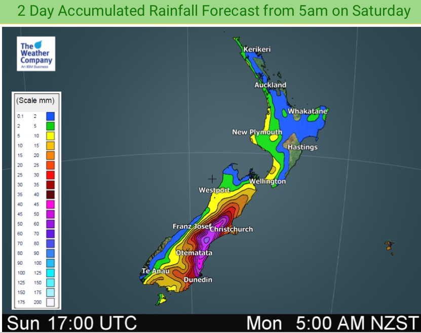
Flooding/ponding risks in Otago and Canterbury next 24 hours (+48hr Rainfall Map)
20/07/2019 12:34am

> From the WeatherWatch archives
Rain is moving in to the eastern South Island with sub-tropical connections encouraging heavy falls (and heavy snow).
Canterbury in particular can flood or get water ponding/surface flooding quite easily with heavy rain events. Typically most rain warnings start around the 60mm mark but parts of Canterbury can flood with just 30mm falling over a few hours.
WeatherWatch.co.nz is forecasting generally 30 to 70mm, mainly between Dunedin and Christchurch. Christchurch is on the cusp of the heaviest rain but surface flooding in the city is possible, especially since the quakes which appeared to have altered and slowed down how well rain water drains away now.
Rain today will be heavy at times in eastern Otago and heavier rain moves into Canterbury as we head through Sunday (and eases gradually in Otago).

– WeatherWatch.co.nz
Comments
Before you add a new comment, take note this story was published on 20 Jul 2019.


Add new comment