Enormous high to bring mainly dry week, warm days & cold nights (+6 Maps)
14/10/2018 9:43pm

> From the WeatherWatch archives
A huge high pressure system anchored over the central Tasman Sea will dominate New Zealand’s weather for the next week ahead, including this weekend.
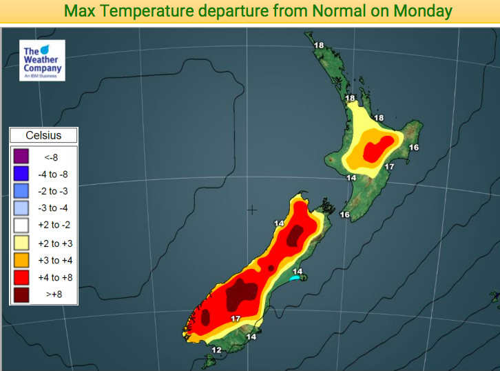
WeatherWatch.co.nz says the enormous high – will spreads from about Fiji to halfway south of Stewart Island and Antarctica – will bring a drier than average week ahead for New Zealand with warmer than average daytime highs but cooler than average nights (at least to begin with).
Warmer sub-tropical winds are likely by Friday and this weekend, pushing temperatures up even further.
Rain is most likely around Fiordland with some spillover into Southland and Westland. A few showers this weekend will affect western areas of both islands but most of New Zealand still looks mainly dry.
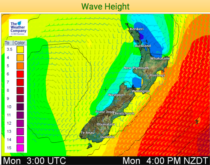
Rough marine conditions brought in by the southerly late last week and Saturday will also ease this week but swells on Monday, especially along the eastern side, are still significant with waves of at least 3.5 metres.


– WeatherWatch.co.nz
Comments
Before you add a new comment, take note this story was published on 14 Oct 2018.


Add new comment