Colder change moving in but not all will have bad weather (+4 Maps)
23/09/2018 2:28am

> From the WeatherWatch archives
Colder air is about to move into the lower part of the South Island while the rest of the country has a cool down on the way, a windier change and the chance for some rain/showers. Sunday, on the other hand, is warmer than average in many places with plenty of sunshine, but winds developing.
A new cold front is moving into and up the lower South Island bringing showers, stronger winds and developing snow over the highlands. For some areas there will be a significant temperature drop over the next 48 hours.
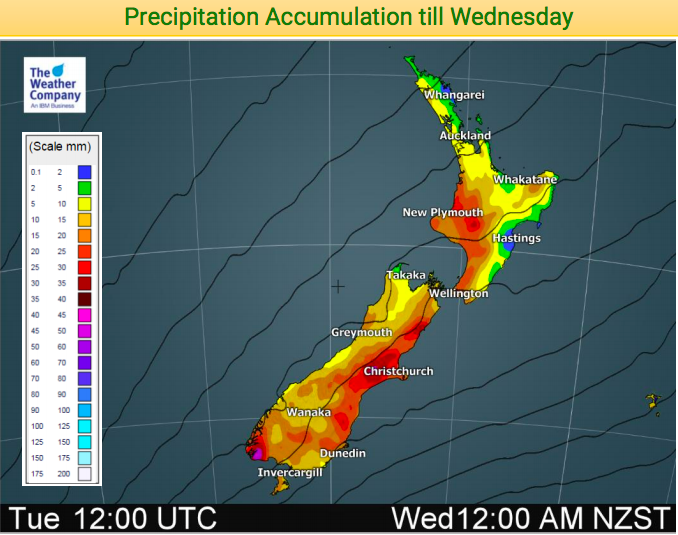
On Monday a front is expected to move northwards across New Zealand. Showers and colder strong winds will spread across many parts of the country, but not all will have bad weather – some will be sunny and mild for a time. But through the highlands/interior and mountainous parts of the South Island snow will develop. In some places it may be heavy snow, so be careful from Monday to early Tuesday if driving through at risk areas.
On Tuesday the low will develop further towards the eastern side of the South Island and move northeastward along the eastern coast of NZ. Showers, snow flurries and white out conditions in highland parts will be generated over the North Island too and the Desert Road may have snow on Monday night or Tuesday.
Late Tuesday, another front is forecast to approach the far south of New Zealand and southwesterly winds will strengthen. Attention is required for the increasing winds over the southern coastal parts. Some in the east may have sunny weather for extended periods this week despite the large system affecting the country.


– WeatherWatch.co.nz
Comments
Before you add a new comment, take note this story was published on 23 Sep 2018.


Add new comment