Big low moves closer to NZ bringing rain, isolated thunder – sunniest in the south (+4 Maps)
2/06/2018 9:53pm

> From the WeatherWatch archives
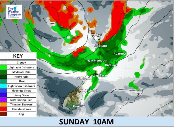
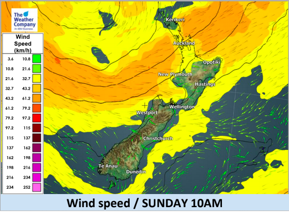
Heavy rain and gales affected Northland on Saturday now heavy rain is crossing Auckland and will continue to track southwards down the island today. Winds have eased further north as the complicated low, that is broken up with areas of wind and rain but also large areas of cloudy but dry and calm too.
As the maps indicate in red below there is the risk of thunderstorms in the upper North Island. Not everywhere in the red coloured zone will have thunder but it highlights the area most likely to have any today and tomorrow. So far this morning there have been a few isolated rumbles around the Northland/Auckland boundary.
The low will continue to move closer to the North Island on Queen’s Birthday Monday with similar areas of rain, showers and dry and plenty of cloud.
Sunniest, driest, weather continues to be in Southland, Otago and South Westland. However the bitterly cold mornings in the southern half of the South Island continue today, but warm up a bit with frosts retreating or becoming much lighter for many in the days ahead.
On Monday the low moves in even closer to the North Island bringing similar weather which stretches further down the eastern South Island bringing a slightly warmer airflow.


Comments
Before you add a new comment, take note this story was published on 2 Jun 2018.


Add new comment