A text book start to Spring this weekend, then a cold change for next week (+8 Maps)
31/08/2018 3:14am

> From the WeatherWatch archives
This weekend heralds the start of spring on the meteorological calendar across the Southern Hemisphere and the forecast for Saturday and Sunday in New Zealand is a classic spring set up. By ‘classic spring set up’ we mean one day is warm, sunny and dry – the next is windy, wet and turning colder.
The Saturday set up sees nor’westers developing across many regions making for a warmer than average day in most parts of the country, by a few to several degrees above normal for this time of the year.
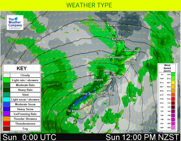
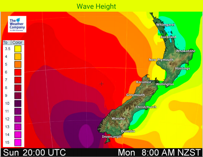
Overnight Saturday and early Sunday arrives the first of a few cold fronts thanks to a deep small low tracking past the lower South Island later this weekend and early next week.
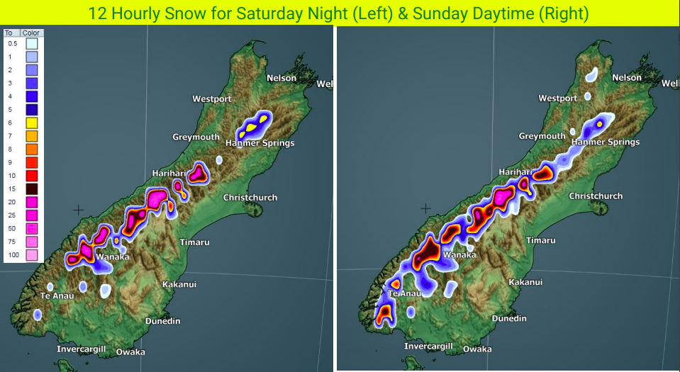
Later on Sunday this colder change sweeps into the North Island and Monday and Tuesday both look colder in a number of regions nationwide. Snow may impact alpine highways in the South Island this weekend and early next week. There may also be a chance of a few snow flurries on the Desesrt Road in the North Island. But a large high moves into the South Island early next week and we return back to frosts thanks to the clear skies behind the southerly. August has lacked southerlies but it seems the first week of September will be colder in many regions, so make the most of this Saturday!
There is some chance frosts will sneak as far north as Waikato and Bay of Plenty mid to late next week thanks to the high pressure system – but it will also bring mostly dry skies with the high likely lingering through next weekend too, which most will find positive. Behind the high (about 9 days from now), winds likely swing back warmer sub-tropical, possibly by Sunday September 9th for some areas.


– WeatherWatch.co.nz
Comments
Before you add a new comment, take note this story was published on 31 Aug 2018.


Add new comment