Weekend Newsfeed: Low pressure brings more pockets of heavy rain, large dry areas too
22/06/2024 10:19pm

> From the WeatherWatch archives
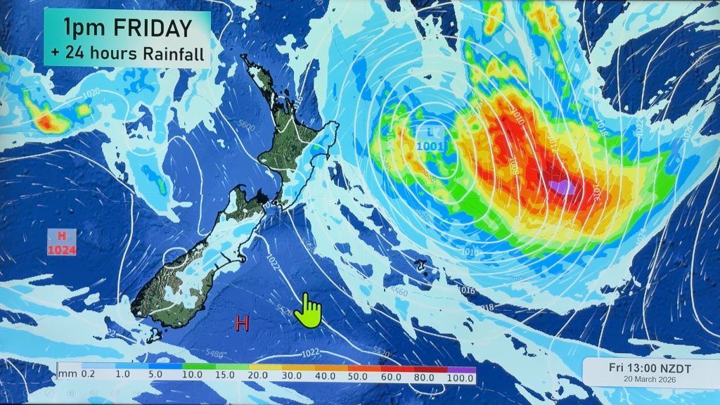
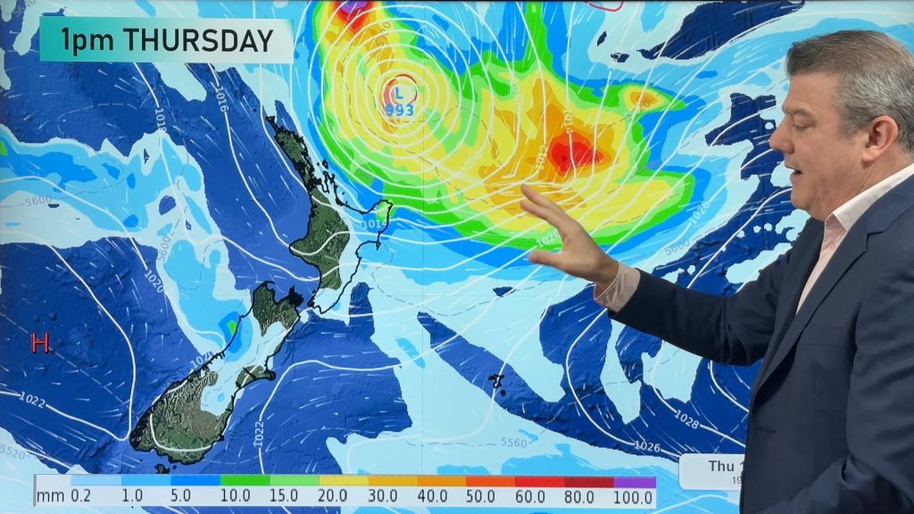
Low pressure has been with NZ for over a week now and later this weekend and early next week it moves back in from the Tasman Sea and crosses the country – and looks to finally clear our shores next week, nearly two full weeks later.
On Sunday and Monday as the central low pressure moves through it will bring more instability – which means areas of rain and showers that go beyond what is forecast. This is quite normal when low pressure is around. Heaviest rain looks to be in the north and west of both main islands, but this will still be fine tuned over the coming days.
Winds will also be strong for a time later on Sunday and into Monday – with northerly gales in some exposed places – then it gets pushed eastwards out over the Pacific Ocean on Monday, replaced by windy westerlies on Tuesday. Monday’s forecast is looking changeable due to the centre of the low moving in, and can’t be locked in this far out.
Due to the instability and changeable nature of this wet weather we advise you to keep up to date with your local rainfall totals we have, but also the general start/peak/end times of the wet weather (which you can see in the “Trends” graphs we have in the WeatherWatch App, or via RuralWeather.co.nz). Because the instability means slow moving rain might break rainfall totals we suggest you also stay up to date with the general rainfall maps for NZ, our latest weather videos, and any MetService warnings or watches. Combine all of them and you should have a much clearer idea of what is going on.
Here are tips on getting fewer nasty surprises when it comes to unstable air-masses and rain forecasts.


- WeatherWatch.co.nz
Comments
Before you add a new comment, take note this story was published on 22 Jun 2024.
Latest Video

Australia: Will Tropical Cyclone Narelle track along half of Oz’s entire coastline?
Tropical Cyclone NARELLE has formed and is heading into northern parts of FNQ, the Katherine region of NT and then…
Related Articles
Australia: Will Tropical Cyclone Narelle track along half of Oz’s entire coastline?
Tropical Cyclone NARELLE has formed and is heading into northern parts of FNQ, the Katherine region of NT and then…
NZ 9 Day: Two subtropical lows, but a lot of dry weather
In our extended outlook today we track two subtropical storms, one that will likely miss most of NZ while the…
Subtropical low (yes, another one) to brush the NI, high pressure still in charge
A subtropical low will power up over the next 24 hours and brush past the north-eastern corner of the North…


Add new comment