Warm today, heavy rain starts Saturday
15/05/2025 10:39pm

Situation
A westerly quarter airflow brings some cloud and the odd shower in the west today, sunny with warm temperatures in the east. High pressure centred over the upper North Island is the overriding factor bringing settled conditions today but this changes on Saturday.

Rain, temperatures and winds today
Cloud brings the odd shower in the west today however north of Auckland should stay dry, Auckland south showers clear up this evening however a few still head into Manawatu.
Warm in the east and for the upper North Island with highs in the late teens or early twenties, western regions are cooler by 5 degrees or so on average especially in regards to the West Coast.
No strong winds although westerly quarter winds may be a little blustery through central New Zealand and about coastal Southland / Stewart Island.
Upcoming potential severe weather
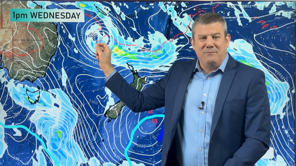
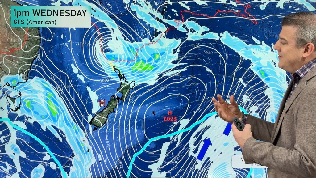
Watches and warnings have been issued in regards to out talked about low and front combination heading in from tomorrow (Saturday).
Heavy rain in the west as a front marches north over the South Island tomorrow brings a chance of thunderstorms, reaching the North Island on Sunday. Strong winds preceding the front may bring gales to the inner South Island east of the Main Divide and through Central New Zealand this weekend.
Watches and warnings can be seen here.
Main story image: Watches and warnings issued this morning by MetService.
Comments
Latest Video

Temperatures to lift, before dropping again this weekend
Subtropical and north-west winds will help boost temperatures around NZ both by day and night followed a colder couple of…
Related Articles
Temperatures to lift, before dropping again this weekend
Subtropical and north-west winds will help boost temperatures around NZ both by day and night followed a colder couple of…
Subtropical low vs subantarctic energy = typical early Autumn setup
A low pressure zone leaving Queensland tonight may brush the very top of the North Island midway through this week…
Subtropical low next week worth monitoring as high pressure controls all
High pressure smothers NZ today and will weaken a little on Sunday and Monday to allow a cooler southerly flow…


Add new comment