VIDEO: Warmer, windier & wetter before potential cold blast
14/08/2024 12:23am

> From the WeatherWatch archives
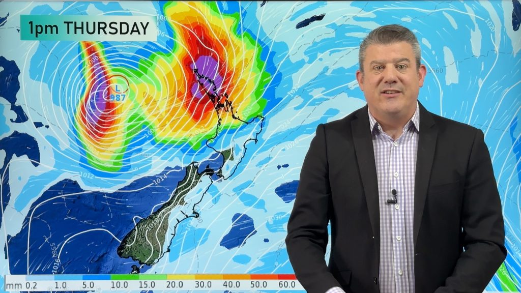
Subtropical airflows and windy nor’westers are about to move through New Zealand over the coming days and weekend and this will bump temperatures above normal for this time of year, especially at night.
Low pressure in the Tasman Sea means some rain and shower activity is likely this coming weekend.
The mild airflows looks to giveway to Antarctic air on Monday for the lower South Island. This is not locked in but is showing up in both your local forecasts and long range computer modelling. We’ll keep tracking it – but today we take a look at what is possible. It looks short lived too – with likely more windy westerlies arriving next week across NZ.
Comments
Before you add a new comment, take note this story was published on 14 Aug 2024.
Latest Video
Tropical low to bring wind & rain this week
A low exiting the tropics near New Caledonia this week will grow larger in the Tasman Sea and finally bring…
Related Articles
Tropical low to bring wind & rain this week
A low exiting the tropics near New Caledonia this week will grow larger in the Tasman Sea and finally bring…

High pressure grows, but a stormy end to next week possible
A settled weekend is on the way and apart from a few isolated showers in both main islands many regions…

A tropical low next week *might* affect NZ
It’s not locked in yet, but a tropical storm may end up drifting southwards towards NZ about one week from…


Add new comment