VIDEO: Update on that North Island low for Easter Weekend
25/03/2024 10:31pm

> From the WeatherWatch archives
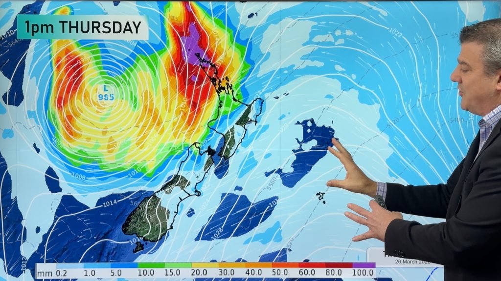
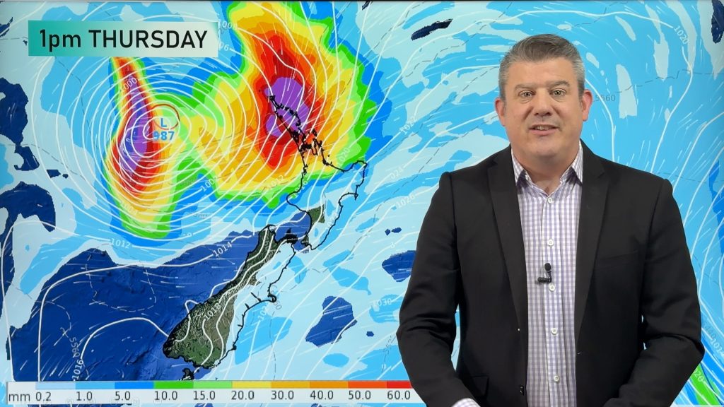
We have another detailed video on how the days ahead are shaping up – and that Easter Weekend low pressure zone we first told you about in yesterday’s video.
The North Island still looks caught up in it with burst of island-wide winds (South to south-east at this stage) and some patches of light and heavier rain and showers, mostly in the east of the North Island but possibly into Canterbury too. We show you two of the world’s most trusted computer models side by side for Saturday’s forecast.
Meanwhile colder air this week is about to move into the South Island – but the South Island’s long weekend looks more settled.
PROGRAMMING NOTES:
- TODAY: Our FINAL Pacific-wide weather update of the season is today (starting in April we’ll include a special 7 day South Pacific update in our MONDAY NZ Videos).
- WEDNESDAY: We have NO VIDEO on Wednesday, sorry
- THURSDAY videos for NZ (and our Australia only video) will be both delayed and not published until mid afternoon.
- GOOD FRIDAY SPECIAL: It’s likely that we’ll have an extra update on Good Friday about the long weekend weather
Comments
Before you add a new comment, take note this story was published on 25 Mar 2024.
Latest Video
Tropical storm to bring severe weather to NZ, gales & heavy rain
A tropical cyclone is today leaving the tropics and will grow into a larger storm system for a time in…
Related Articles
Tropical storm to bring severe weather to NZ, gales & heavy rain
A tropical cyclone is today leaving the tropics and will grow into a larger storm system for a time in…
Tropical low to bring wind & rain this week
A low exiting the tropics near New Caledonia this week will grow larger in the Tasman Sea and finally bring…

High pressure grows, but a stormy end to next week possible
A settled weekend is on the way and apart from a few isolated showers in both main islands many regions…


Add new comment