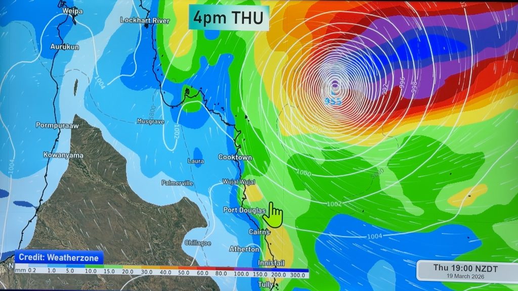
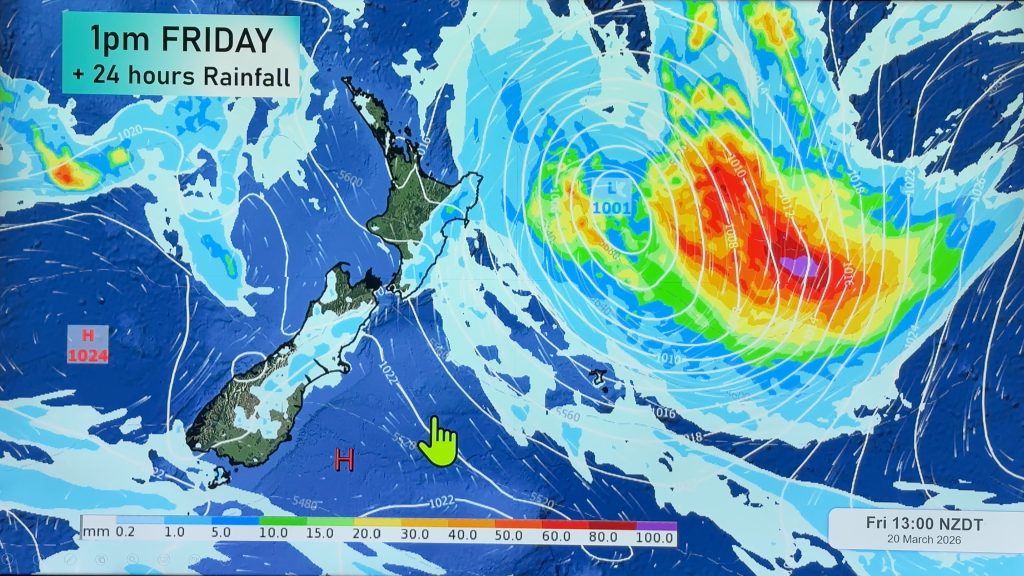
VIDEO: Tropical Cyclone Gabrielle on track to hit NZ
8/02/2023 10:46pm

> From the WeatherWatch archives
It’s an extremely concerning set-up, one that may see a few days of severe across New Zealand as Tropical Cyclone Gabrielle strengthens further today.
Global modelling suggests there is a high risk for New Zealand, especially the upper North Island which may well take a direct hit from the centre of the storm.
While confidence is high the cyclone will reach NZ, there still remains some uncertainty about the precise tracking of the centre.
We explain what is driving the set-up next week and how high pressure could make it worse or better.
For Australia, the mainland is mostly unaffected weather-wise – but Norfolk Island may well get a direct hit on Saturday night from the eye of the cyclone.
Comments
Before you add a new comment, take note this story was published on 8 Feb 2023.


Add new comment
Gordon Robertson on 9/02/2023 11:56pm
Is there going to be a new video release yesterday’s one was very informative-good work)
Reply
WW Forecast Team on 10/02/2023 12:36am
New video is out 🙂
Aaron
Reply
janet on 9/02/2023 9:19pm
may i please ask can we have storm tracker and alot of people ask different things my question is will this storm impact wellington and hutt valley so many people want to know thankyou
Reply
WW Forecast Team on 9/02/2023 10:51pm
Hi Janet, keep an eye our news feed and daily videos – they will help keep you informed on top of the MetService WATCHES and WARNINGS that are now starting to be generated.
Wellington / Hutt valley has some wind and rain from this event – gale S to SE winds and maybe 70 to 100mm of rain (based on the latest best thinking) during next week.
https://www.ruralweather.co.nz/forecasts/Hutt%20Central,%20Lower%20Hutt,%20Wellington
– WW
Reply
Jo Steel on 9/02/2023 6:40pm
Brilliant explanations, thank you. My favourite weather app!
Reply
Kim on 9/02/2023 11:36am
How likely is it the central south island (inland nth canty, oxford) will get any of this? Particularly strong winds, and what direction?
And if you don’t know the answer to that now, when are you likely to be able to give me a better idea of this?
Thanks
Reply
Richard England on 9/02/2023 8:00pm
Hello Kim, if you look at ruralweather.co.nz you’ll see a decent amount of rain for Tues-Weds with winds out of the South but not particularly strong.
https://www.ruralweather.co.nz/forecasts/Oxford,%20Canterbury
P.S. I’m not affiliated with WeatherWatch
Reply