VIDEO: Subtropical storm to unravel over NZ for long weekend
16/04/2025 8:52pm

Severe gales, heavy rain and travel disruptions are setting in for NZ as a sub-tropical storm powers up for Thursday, before weakening this long weekend.
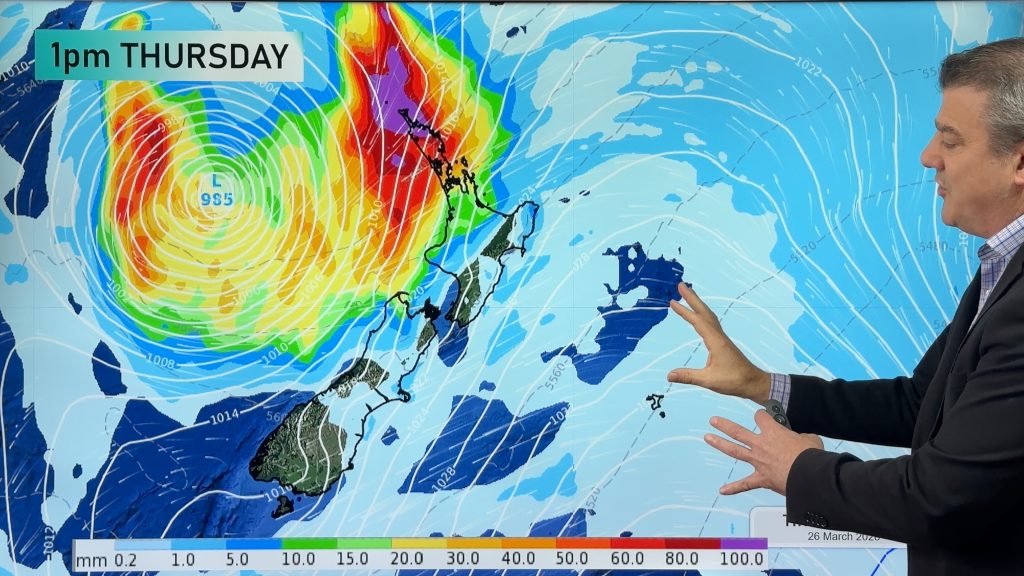
The low was named Cyclone Tam on Tuesday night by the Fiji MetService but lost that technical “tropical cyclone” status on Wednesday afternoon and become a “subtropical storm” – less than 24 hours later. But the storm is actually stengthening today. The low will get larger as it stalls over the Tasman Sea and merges with more low pressure – powering it all up further on Thursday, before it weakens this long weekend.
Between the large storm, and a very powerful high pressure zone to our south-east, we can expect damaging winds in the upper North Island. What we call a “squash zone”.
Rain will be slow moving due to the blocking high to our east… therefore rain may linger through until next week for some regions.
We have extensive details as we go into the long Easter Weekend with pockets of severe weather around New Zealand.
Our next video update should be out by 1pm today.
Comments
Latest Video

Update on severe weather around NZ as storm moves in + outlook for next week
Heavy rain and damaging wind gusts are forecast today, tonight and into Friday across parts of New Zealand as a…
Related Articles
Update on severe weather around NZ as storm moves in + outlook for next week
Heavy rain and damaging wind gusts are forecast today, tonight and into Friday across parts of New Zealand as a…

Subtropical storm moving in, gales and some heavy rain, especially Thu/Fri
Heavy rain and gale winds will slowly move down the country over the next 24 to 36 hours a subtropical…
Tropical storm to bring severe weather to NZ, gales & heavy rain
A tropical cyclone is today leaving the tropics and will grow into a larger storm system for a time in…


Add new comment
Anthony on 17/04/2025 12:26am
Good coverage as usual. Why are you still on Twitter though? Don’t support the fascists.
Reply
WW Forecast Team on 17/04/2025 12:48am
Thank you! Also – We’re on X because that’s what mainstream news outlets use.
-WW
Reply
B on 16/04/2025 4:42am
TC Bola repeat as TC Tam?
Reply
WW Forecast Team on 16/04/2025 5:34am
Hi there, no not at this stage. No two storms are ever the same. Each produce different outcomes and each have different set-ups (even when they look similar).
– WW
Reply