VIDEO: Sub-tropical storm to bring severe gales, heavy rain Wed – Fri
14/04/2025 12:55am
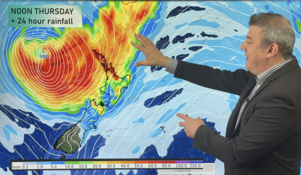
A tropical low is deepening near Vanuatu today and will power up in the sub-tropics as it drops southwards towards NZ – and then interacts with a powerful high pressure system to our east.
We call this windy area between the low and high a “Squash zone” and this creates stronger and stronger north-east winds and then slows down the sub-tropical rain – bringing a burst of severe wind and rain to northern parts of both main islands, but in particular the North Island.
We break down wind, rain, waves and the nationwide set-up between now and covering the long weekend.
Comments
Latest Video

High pressure grows, but a stormy end to next week possible
A settled weekend is on the way and apart from a few isolated showers in both main islands many regions…
Related Articles
High pressure grows, but a stormy end to next week possible
A settled weekend is on the way and apart from a few isolated showers in both main islands many regions…

A tropical low next week *might* affect NZ
It’s not locked in yet, but a tropical storm may end up drifting southwards towards NZ about one week from…

Australia: Will Tropical Cyclone Narelle track along half of Oz’s entire coastline?
Tropical Cyclone NARELLE has formed and is heading into northern parts of FNQ, the Katherine region of NT and then…


Add new comment
Adalene Harris on 16/04/2025 3:55am
If it’s raining it’s raining it’s algud I would be disappointed if it stops. Love it 😁
Reply
millsy on 14/04/2025 11:10pm
How long is this going to last for? And dont you think its a little unfair for this bad weather to happen at Easter? We already had our fill of bad weather 2 weeks ago. Why more?
Reply
WW Forecast Team on 15/04/2025 12:33am
How can you can say it’s unfair when it’s barely rained all year in northern NZ?!
– WW
Reply
millsy on 15/04/2025 1:39am
We had a storm 2 weeks ago. But unfair that we have to go through another one. Why can it not be sunny right thru the long weekend?
Reply
Jacques on 15/04/2025 8:40am
Because it’s autumn and that means changeable weather. Get over it that’s how the weather is in NZ
Reply
millsy on 15/04/2025 10:53pm
Touch a nerve, did I?
Reply