VIDEO: Sub-tropical low to bring wind & rain before enormous high pressure zone
29/04/2025 1:30am

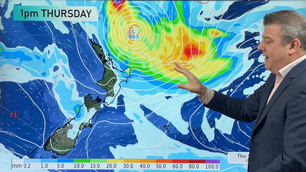
Pockets of heavy rain, isolated thunderstorms and gale force winds will be spreading around parts of NZ for today, Wednesday and Thursday as low pressure drops down over the country from the sub-tropics. Interacting with high pressure departing – and then incoming new high pressure – we’ll see a burst of East to North-East winds today and tonight, followed by a surge of gale South to South-West winds on Thursday (strongest around the lower North Island).
Rain bands will be messy – meaning some of those downpours may be hit and miss for some.
Not all regions are affected – especially those in the lower third of the South Island, where a colder southerly flow is about to kick in.
But by Friday and this weekend in comes a high pressure zone as big as Australia – and that looks set to bring a settled first week of May to most, if not all, parts of New Zealand.
We have your forecast through to Monday of next week.
Comments
Latest Video
Subtropical low (yes, another one) to brush the NI, high pressure still in charge
A subtropical low will power up over the next 24 hours and brush past the north-eastern corner of the North…
Related Articles
Subtropical low (yes, another one) to brush the NI, high pressure still in charge
A subtropical low will power up over the next 24 hours and brush past the north-eastern corner of the North…
NZ weather: Skies will get drier before they get any wetter
High pressure is the main feature of New Zealand’s weather this week, the upcoming weekend and likely kicking off next…

NZ 8 Day: High pressure to return, also monitoring tropics next week
A cooler change is moving into NZ tonight and Saturday then winds ease further on Sunday as high pressure starts…


Add new comment