VIDEO: Spring is doing its thing!
2/09/2025 1:09am
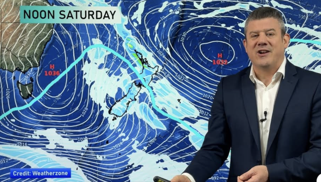
High pressure will briefly bring some settled weather to the country for Wednesday and Thursday but the next cold front arrives Friday in the South Island and goes nationwide on Saturday – with polar air covering the entire nation.
Surges of windy weather and temperature changes are on the way over the coming week – with snow on the mountains and ranges, especially in the South Island and plenty of westerly driven rain (driest in the east).
There’s also a low developing in the subtropics one week from now – the current modelling keeps it offshore, but it’s large and close enough to monitor.
We have your detailed New Zealand forecast through to Tuesday next week.
Comments
Latest Video
Yes, NZ’s weather is warming back up again
Temperatures lift on Wednesday for many, then further going into Thursday and Friday as subtropical and/or nor’westers return. Cooler southerlies…
Related Articles
Yes, NZ’s weather is warming back up again
Temperatures lift on Wednesday for many, then further going into Thursday and Friday as subtropical and/or nor’westers return. Cooler southerlies…
ClimateWatch: MARCH is looking quite orderly to start with
Storms near Antarctica, Autumn’s westerlies building south of Australia & NZ, high pressure again affecting both nations and the tropics…
Colder tonight for many, Lunar eclipse Tuesday, high pressure dominates
A lot of low pressure is spinning east of the country while a large high is moving in – this…


Add new comment