VIDEO: Special Update: Cyclone Jasper Category 2 makes landfall
13/12/2023 10:24am

> From the WeatherWatch archives
Update 11:24pm Weds — Tropical Cyclone Jasper has made landfall in Far North Queensland, north of Cairns and south of Cooktown.
Comments
Before you add a new comment, take note this story was published on 13 Dec 2023.
Latest Video
9/04/2026 12:21am
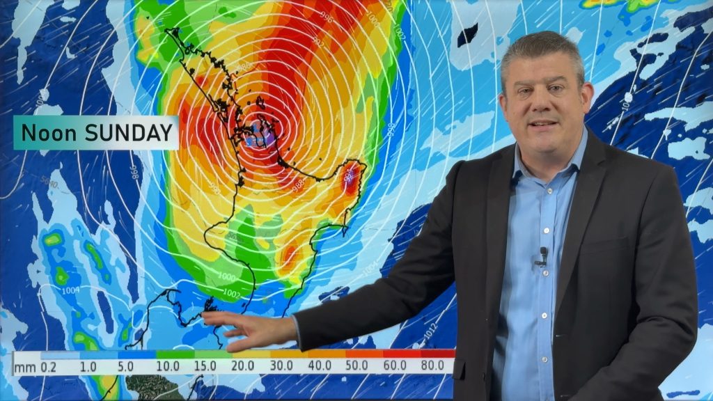
NZ (THU): Latest on Cyclone Vaianu, Sunday landfall in North Island
Severe weather is expected to develop as early as Saturday in the upper North Island ahead of Cyclone Vaianu, which…
Related Articles
9/04/2026 12:21am
NZ (THU): Latest on Cyclone Vaianu, Sunday landfall in North Island
Severe weather is expected to develop as early as Saturday in the upper North Island ahead of Cyclone Vaianu, which…
7/04/2026 11:25pm
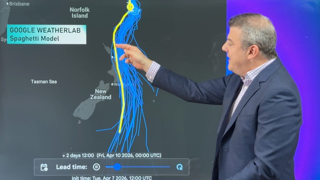
Tropical Cyclone Vaianu’s track directly into NZ this weekend
Localised heavy rain is still affecting some parts of NZ today, seperate to the tropical cyclone which is tracking directly…
7/04/2026 7:15am
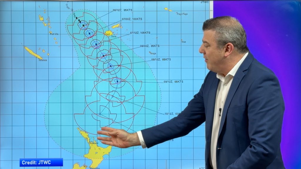
Tropical Cyclone VAIANU: Fiji then NZ
*Published Tuesday AM* Fiji is being affected today by offshore Severe Tropical Cyclone Vaianu and NZ has the chance of…


Add new comment