VIDEO: Significant gales for Thursday + Labour Weekend Update
21/10/2025 11:39pm
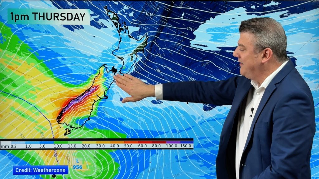
The next surge of damaging winds are moving into the South Island overnight tonight and through Thursday, along with the lower half of the North Island.
Canterbury (and regions near it) may be in for damaging severe gales from overnight tonight until Thursday evening – when windy weather looks to ease back from the daytime peak.
Heavy West Coast rain is in the mix too.
This long weekend is partially unsettled but still many regions have dry weather and/or lighter winds. But the next surge of rain and gales develops later on Sunday and into Labour Day Monday for some regions.
Comments
Latest Video
Rare blood moon lunar eclipse tonight + Yes, NZ’s weather is warming back up again
We had our coldest morning of the year so far today and tonight will also be a little cool (but…
Related Articles
Rare blood moon lunar eclipse tonight + Yes, NZ’s weather is warming back up again
We had our coldest morning of the year so far today and tonight will also be a little cool (but…
ClimateWatch: MARCH is looking quite orderly to start with
Storms near Antarctica, Autumn’s westerlies building south of Australia & NZ, high pressure again affecting both nations and the tropics…
Colder tonight for many, Lunar eclipse Tuesday, high pressure dominates
A lot of low pressure is spinning east of the country while a large high is moving in – this…


Add new comment
Huia on 22/10/2025 1:47am
Is there damaging winds for gisborne tomorrow
Reply
WW Forecast Team on 22/10/2025 3:38am
Hi Huia, winds may become very gusty for a time on Thursday afternoon – but it’s borderline for damaging gusts.
– WW
Reply
Huia on 22/10/2025 4:32am
Do you know how strong the gust and wind speeds are for gisborne city
Reply
WW Forecast Team on 22/10/2025 7:48am
Yep – take a look at https://www.ruralweather.co.nz/forecasts/Gisborne and it will show you the wind graphs to make sense of it all (Also these graphs are available in our free WeatherWatch app). Please note gusts in NZ can always go higher, due to the ranges/hills in our regions.
Cheers 🙂
– WW
Reply