VIDEO: Low pressure for the NI today & tonight, A cold change on Fri PM/Sat AM for the SI
11/11/2025 11:24pm
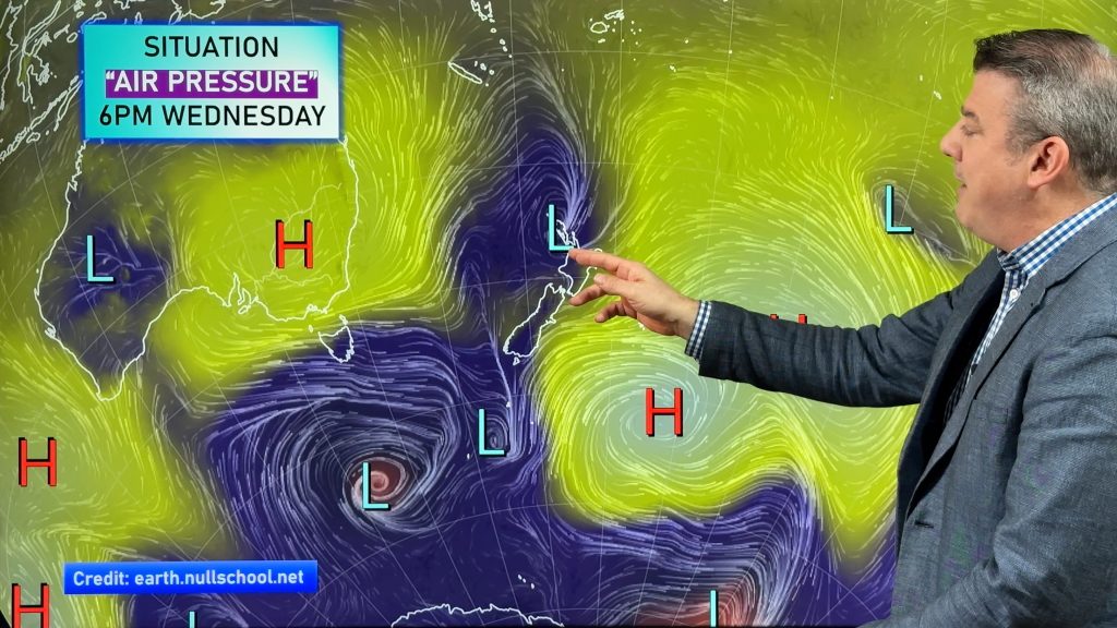
Low pressure is moving into the upper North Island today and tonight and will sink southwards overnight, clearing NZ later tomorrow. With it comes a burst of strong East to North-East winds and patchy rain with pockets of heavy downpours. Keep up to date with any MetService watches and warnings.
Windy weather also affects the south-east South Island (like coastal Otago) as a windy nor’easter kicks in today due to high pressure out over the Chatham Islands and low pressure south of Stewart Island making a “squash zone” of wind.
By Friday the next polar change moves into the South-West corner of the South Island – and overnight and into Saturday morning spreads right over the South Island and may even brush Wellington and the lower North Island for a time, before clearing NZ by night time with warmer weather arriving on Sunday and into early next week.
Subtropical winds and subantarctic winds are forecast for NZ over the next 7 days.
Comments
Latest Video

Weather for Christmas & NYE: The good, the bad and the ugly…
Low pressure, windy weather, hot and cold – it’s all in the mix over the coming days, bringing both hot…
Related Articles
Weather for Christmas & NYE: The good, the bad and the ugly…
Low pressure, windy weather, hot and cold – it’s all in the mix over the coming days, bringing both hot…
Santa Tracker 2025
Track Santa’s progress this Christmas Eve with the 2025 WeatherWatch Santa Tracker! We expect Santa to show up some time…
Latest Christmas forecast + New Year’s Eve outlook
We have an extended forecast covering the rest of 2025 as a cold change looks set to kick in from…


Add new comment