VIDEO: Heavy downpours/thunder, then a windy SW flow for the long weekend
28/05/2025 12:16am

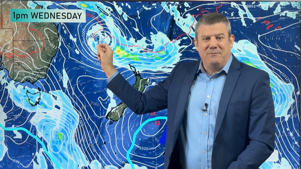
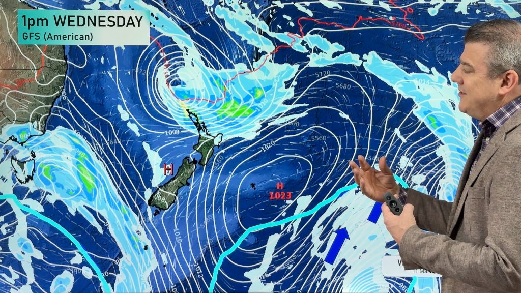
A large low in the Tasman Sea is moving into NZ with pockets of heavy rain, strong winds – and isolated thunderstorms and downpours.
Rain bands move in later today and again on Thursday as this very large low inches closer. Low pressure creates instability in the atmosphere which can make for sudden downpours that can break what is forecast to fall – so tracking on the rain radar is helpful over the next few days as some downpours may surprise people.
By Friday a cold and much windier South-West flow moves in and will linger for the entire long weekend – bringing western and southern showers along NZ, and driest weather in the east of both main islands.
We have your full forecast through to Tuesday next week.
Comments
Latest Video

Temperatures to lift, before dropping again this weekend
Subtropical and north-west winds will help boost temperatures around NZ both by day and night followed a colder couple of…
Related Articles
Temperatures to lift, before dropping again this weekend
Subtropical and north-west winds will help boost temperatures around NZ both by day and night followed a colder couple of…
Subtropical low vs subantarctic energy = typical early Autumn setup
A low pressure zone leaving Queensland tonight may brush the very top of the North Island midway through this week…
Subtropical low next week worth monitoring as high pressure controls all
High pressure smothers NZ today and will weaken a little on Sunday and Monday to allow a cooler southerly flow…


Add new comment
John on 28/05/2025 9:34pm
Hi, are you planning on doing a prediction for the first month of Winter?
Reply
WW Forecast Team on 28/05/2025 10:15pm
Hi John, yes our June outlook will be issued tomorrow afternoon (ClimateWatch).
– WW
Reply