Category 1 Cyclone Tam forms north of NZ, severe weather risks for NZ (News, Video, Maps)
15/04/2025 8:00am

Updated 8:49pm: A tropical cyclone has formed near Vanuatu and while short lived (likely only a day or two, as it’s tracking south out of the tropics) it will soon morph into a new storm system in the NZ area. This is what tropical cyclones do when they move southwards and leave the “tropical” part that creates them. As they change into this new, colder air, fuelled storm/low near our country the severe weather moves out from the centre and becomes scattered further afield – this process will create areas of severe weather for parts of NZ in the coming days.
At the time of recording this video the cyclone was not officially named by the Fiji Met Service – but tonight the Fiji Met Service named the Tropical Cyclone “Tam”.
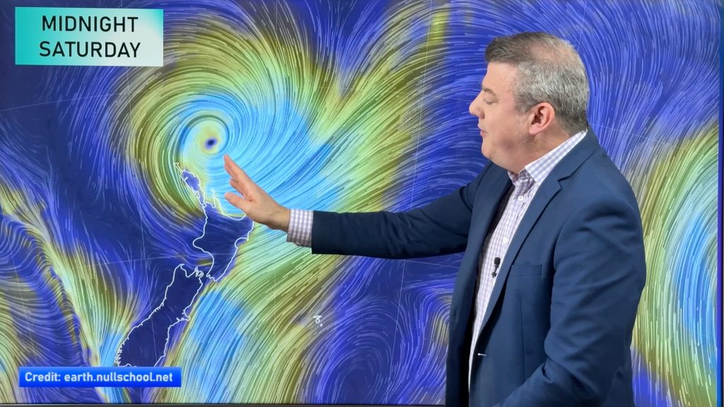
Cyclone Tam is now a Category 1 storm with gale force winds around the centre. Category 1 is damaging, but it is also the lowest on the tropical cyclone scale (which goes up to five). In comparison, Cyclone Gabrielle had Category 3 strength when it reached New Zealand just over two years ago.
Ex-cyclones, even once winds have eased, can bring flooding if high pressure near New Zealand slows it down – or stalls the rain in one area for days. High pressure is likely to be in that position in the days ahead, which is why forecasters are tracking this low so closely.
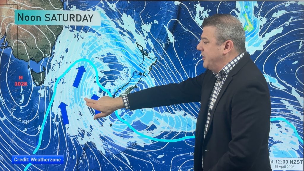
Powerful high pressure to the east of NZ will create a “squash zone” (a line of windy nor’east weather) as the storm approaches NZ in the next two days.
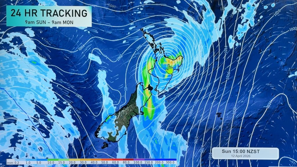
Heavy rain will also slide southwards with heaviest falls in the north of both main islands. High pressure may well stall the rain in some nothern regions which means forecasts may change, especially due to our mountains and ranges breaking up some of the flow of rain and wind as this all moves through. Also the low will be changing shape in the days ahead – that also alters where the bulk of the severe weather goes.
Slips, flooding, large waves and travel problems are all possible over the next few days in certain regions.
There will also be dry and calm areas across some areas with below normal rainfall for this time of year (mostly southern parts of both main islands – but see the video for more).
We give you the next full forecast for this week and the long Easter Weekend on Wednesday.


- WeatherWatch.co.nz
Comments
Latest Video
Autumn westerlies kick in, large weekend low coming
This week we switch gears, shifting into a more classic Autumn weather pattern with cold fronts, windy westerlies and nor’westers,…
Related Articles
Autumn westerlies kick in, large weekend low coming
This week we switch gears, shifting into a more classic Autumn weather pattern with cold fronts, windy westerlies and nor’westers,…
NZ (SUN): Cyclone Vaianu moves across the North Island
Cyclone Vaianu made landfall in Bay of Plenty this afternoon and is now moving into Hawke’s Bay, with the centre…
NZ (SAT): Updated forecast for Cyclone Vaianu
We have the latest tracking of Vaianu as the subtropical cyclone moves into the upper North Island tonight, and across…


Add new comment
Shar on 15/04/2025 9:05pm
Thanks for the report. I was supposed to travel to Nelson but your info has put that trip on hold. I’m disappointed with the weather but glad I’m not heading into this storm. I’ll stay in the deep south and ride this one out
Reply
Karan on 15/04/2025 2:13pm
Thanks for the reporting. Is the rain and wind going to be heavy in coromandel on both Thursday and Friday as we have a camping trip booked. Campground saying because there spot is inside a valley, they woo not be affected by wind much at all.
We are thinking reaching campground on Friday around 8am as hopefully weather has settled by then and less Easter traffic?
Reply
Alice on 15/04/2025 9:21am
Thanks for the detailed breakdown and update!!
Reply
WW Forecast Team on 15/04/2025 9:23am
Much appreciated 🙂
– WW
Reply
C on 15/04/2025 4:48am
Top notch report- thank you.
Reply
WW Forecast Team on 15/04/2025 9:22am
Thank you!
– WW
Reply