VIDEO: Flood risk for VIC, NZ monitors sub-tropical low
9/10/2022 11:38pm

> From the WeatherWatch archives
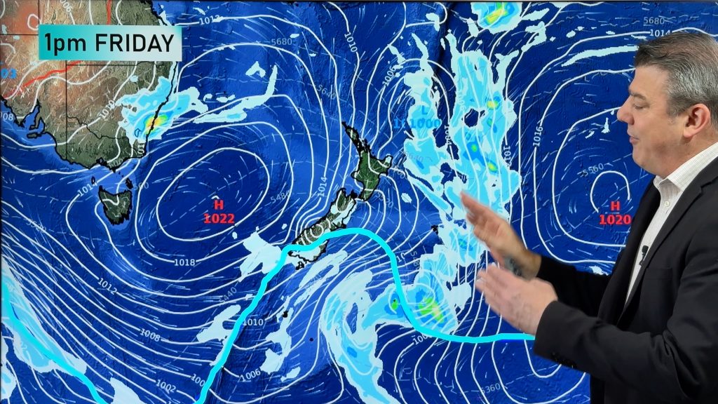
A significant rain event in Australia’s south east corner as NZ monitors a sub-tropical low – these are the two main features of the weather this week in our part of the world.
NZ – This week is much warmer and more settled compared to conditions a week ago, with easterlies, northerlies and westerlies the dominant airflows (no polar southerlies!). Some rain on the West Coast with heavy falls south of the glaciers, but elsewhere only a few showers are mostly in the forecast with most regions leaning drier. By Saturday a sub-tropical low from Tonga will be very near the North Island… for now it looks to remain just offshore, but it’s worth monitoring incase it does bring some wind and rain to northern NZ.
Australia – A significant rain event (yes, another one) for parts of VIC and TAS (and maybe some inland parts of NSW). Up to 150mm is possible with localised slips and flooding – and more rain for the Murray River catchment area to the east. Wettest day will be Thursday then spring-like windy (possibly gale) westerlies kick in by Friday with drier skies. The good news? High pressure is on the way this weekend.
Comments
Before you add a new comment, take note this story was published on 9 Oct 2022.


Add new comment