VIDEO: Cyclone Alfred (Friday) – Latest on gales, rain, tracking
6/03/2025 11:30pm

> From the WeatherWatch archives
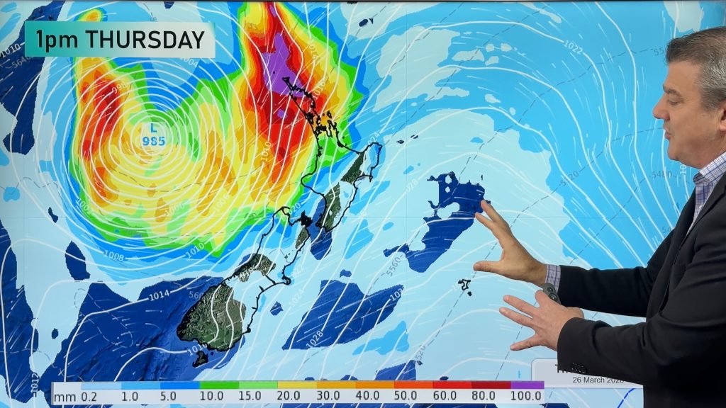
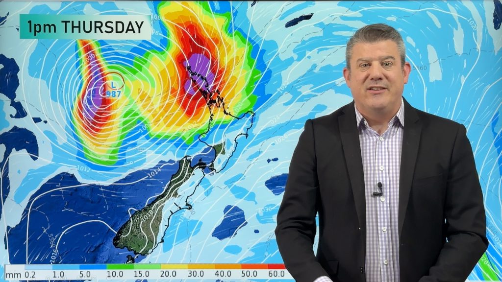
We have Friday’s latest maps and modelling on Tropical Cyclone Alfred as it moves into Queensland and NSW.
First we cover wave heights.
Then we cover wind gusts moving through over the next 48 hours and into next week.
Finally we wrap up with rain maps and total rainfall.
Our next update will be on Saturday morning.
Comments
Before you add a new comment, take note this story was published on 6 Mar 2025.
Latest Video
Tropical storm to bring severe weather to NZ, gales & heavy rain
A tropical cyclone is today leaving the tropics and will grow into a larger storm system for a time in…
Related Articles
Tropical storm to bring severe weather to NZ, gales & heavy rain
A tropical cyclone is today leaving the tropics and will grow into a larger storm system for a time in…
Tropical low to bring wind & rain this week
A low exiting the tropics near New Caledonia this week will grow larger in the Tasman Sea and finally bring…

High pressure grows, but a stormy end to next week possible
A settled weekend is on the way and apart from a few isolated showers in both main islands many regions…


Add new comment
Joy on 7/03/2025 1:15pm
Excellent. Straight forward, no nonsense, super informative. Thankyou from Brisbane.
Reply
Trish on 7/03/2025 7:26am
Thank you so much for your informative updates, you’re the best in the business and it’s great to hear such a comprehensive report without any of the misleading hype. We’re in Brisbane and unfortunately we’re just waiting, waiting, waiting……
Reply
Craig Haggart on 7/03/2025 5:37am
Awesome job the most comprehensive so far welldone
Reply
Abby on 7/03/2025 3:24am
Excellent reporting, really appreciate your work. It’s great to have it all pulled together, well-communicated and timely.
Reply
Melinda on 7/03/2025 2:26am
What informative updates…. Wish this could be shown on free to air TV. Myself and others after watching these updates actually learnt how , when and why this happens. Makes it easy to understand and maybe helps others to prepare a little better.
Keep up your good work, glad I was told about this link.
Reply
Jennie on 7/03/2025 1:41am
Best coverage
Best explanation
Rain maps best graphic
Nice work
Reply
greig Lipman on 7/03/2025 1:34am
wonderful, easy to grasp and confident description of what is happening and what to expect. Highly Professional
Reply
Mark on 7/03/2025 12:03am
Thank you. Wonderful coverage. Non-sensational information re TC Alfred. As a Brisbane inhabitant I’m so grateful to have found your site. Keep up the good work team.
Reply