VIDEO: Cold fronts are coming – but large dry areas too
15/05/2024 12:32am

> From the WeatherWatch archives
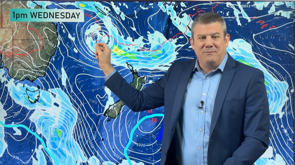
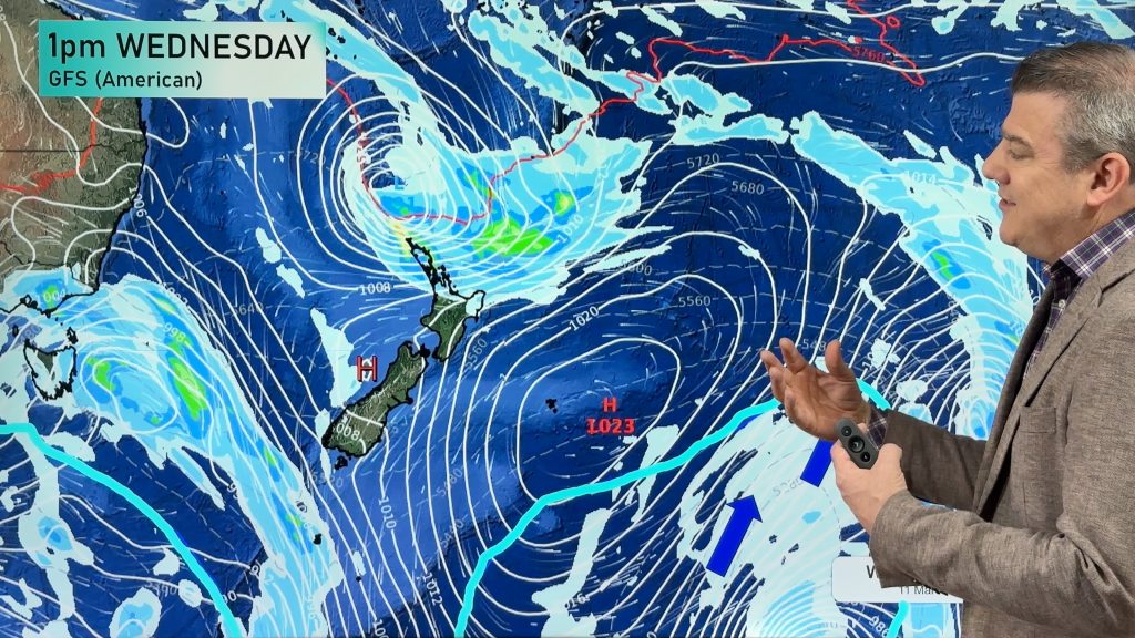
Cold fronts bringing some alpine snow and sea level rain and showers are in the forecast for parts of NZ this week and next – but many large areas will also be dry and sunny as wind flows move around high and low pressure zones. This week highlights just what Autumn (and spring) can be all about – chaotic and messy weather patterns.
\We’ve had northerlies, easterlies, westerlies and southerlies this week around NZ and more to come over the next several days. Many who had heaters, fires and heatpumps going on Tuesday may today have doors and windows open. However a huge block of high pressure remains stubbornly stuck south of Australia – bringing severely dry weather into the south and south east of their nation. These highs are limiting rain events into NZ and are also encouraging many of the cold fronts and southerlies we’re getting.
We have your forecast for the rest of this week, weekend and the start of next week too.
Comments
Before you add a new comment, take note this story was published on 15 May 2024.
Latest Video

Temperatures to lift, before dropping again this weekend
Subtropical and north-west winds will help boost temperatures around NZ both by day and night followed a colder couple of…
Related Articles
Temperatures to lift, before dropping again this weekend
Subtropical and north-west winds will help boost temperatures around NZ both by day and night followed a colder couple of…
Subtropical low vs subantarctic energy = typical early Autumn setup
A low pressure zone leaving Queensland tonight may brush the very top of the North Island midway through this week…
Subtropical low next week worth monitoring as high pressure controls all
High pressure smothers NZ today and will weaken a little on Sunday and Monday to allow a cooler southerly flow…


Add new comment