VIDEO: Aussie – Rain returns to southern states! Sun returns to north.
6/06/2024 12:39am

> From the WeatherWatch archives
The weather pattern looks better for those wanting rain in the southern half of the nation – and for those wanting sun in the north east.
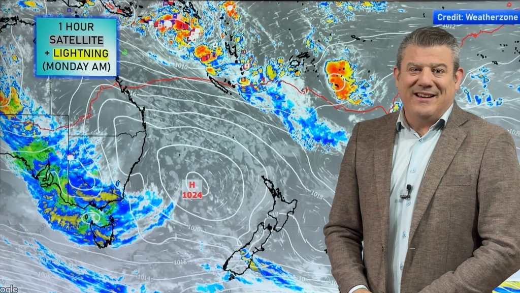
A number of lows will bring wet weather to WA, SA, VIC, NSW and TAS with them brushing A.C.T too – although frosty weather is back on the cards there and at higher elevations as far north as southern Queensland.
But the wet weather is the main headline for most with the southern half of WA, VIC, NSW and TAS most in the firing line for rain. It’s not rain relief for all, but it’s certainly a big improvement. NSW has highest totals due to the second east coast low in a week, which may dump over 150mm in some locations around Sydney (plus or minus 200km as it’s a narrow band of rain that isn’t 100% locked in).
For those further north in Queensland it’s the opposite – the sun is coming back out with many places having over a week (or more) of clear to mostly clear skies, to make up for months of cloudy easterlies!
SA – you’re the only southern state that’s in a bit of a rain shadow and may not get much – but a few showers are expected in the coastal south, especially down towards Mount Gambier.
We also have your 7 day rainfall outlook to make sense of it all.
Comments
Before you add a new comment, take note this story was published on 6 Jun 2024.
Latest Video
NZ weather: Skies will get drier before they get any wetter
High pressure is the main feature of New Zealand’s weather this week, the upcoming weekend and likely kicking off next…
Related Articles
NZ weather: Skies will get drier before they get any wetter
High pressure is the main feature of New Zealand’s weather this week, the upcoming weekend and likely kicking off next…

NZ 8 Day: High pressure to return, also monitoring tropics next week
A cooler change is moving into NZ tonight and Saturday then winds ease further on Sunday as high pressure starts…

Unsettled Thu/Fri, high pressure returns this weekend & next week
Wind and some wet weather is moving into both ends of NZ today and tomorrow bringing broken up rain bands…


Add new comment